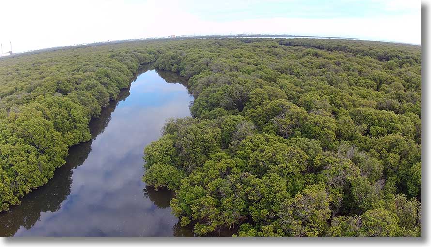
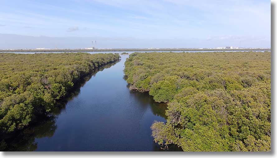
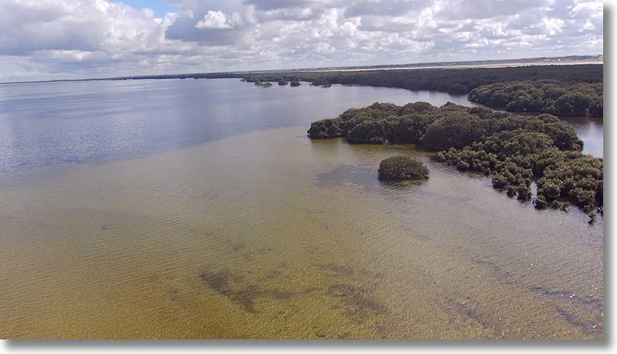
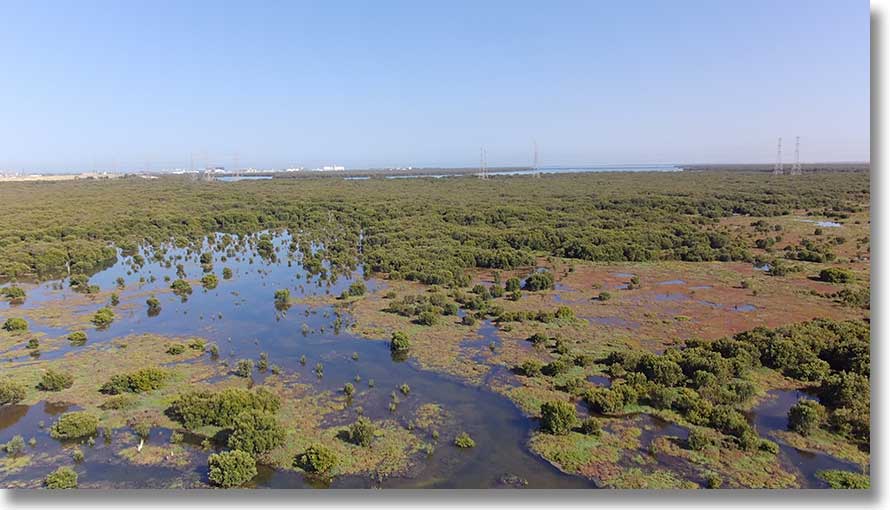
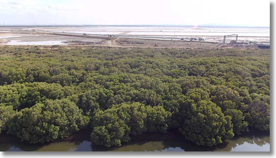
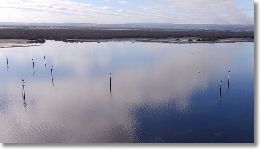
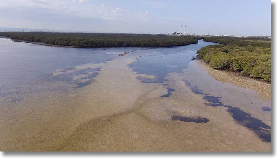
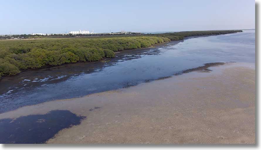
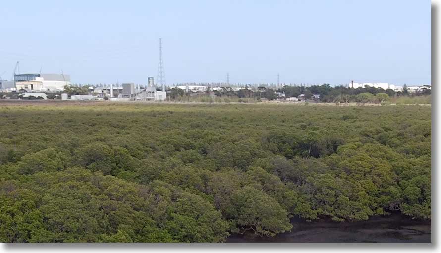
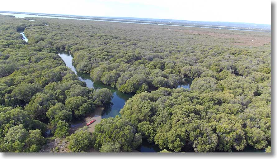
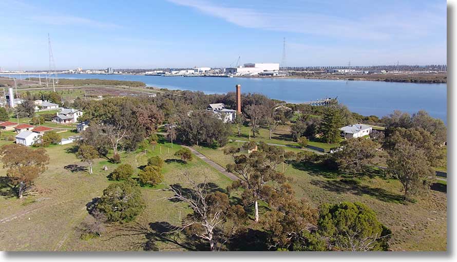
Torrens Island environs aerial
This page is an attempt to look at the Torrens Island and Barker Inlet area from a different perspective, one that can’t be seen from water level. It is a work in progress: images will be added and replaced as new ones are made. It’s a supplement to the ‘Notes on the Torrens Island and Environs map’ page.
When I was doing my flying training in the 1960s out of Parafield I often flew across the Torrens Island area. I took photographs of some landmarks, but none really detailing the the creeks. Four examples:
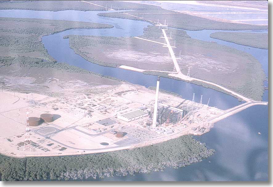
The Torrens Island A power station under construction. No boating clubs in Angas Inlet at this stage. Santiago and Dorothy H Sterling are visible in North Arm, as are other vessels in the graveyard at far right.
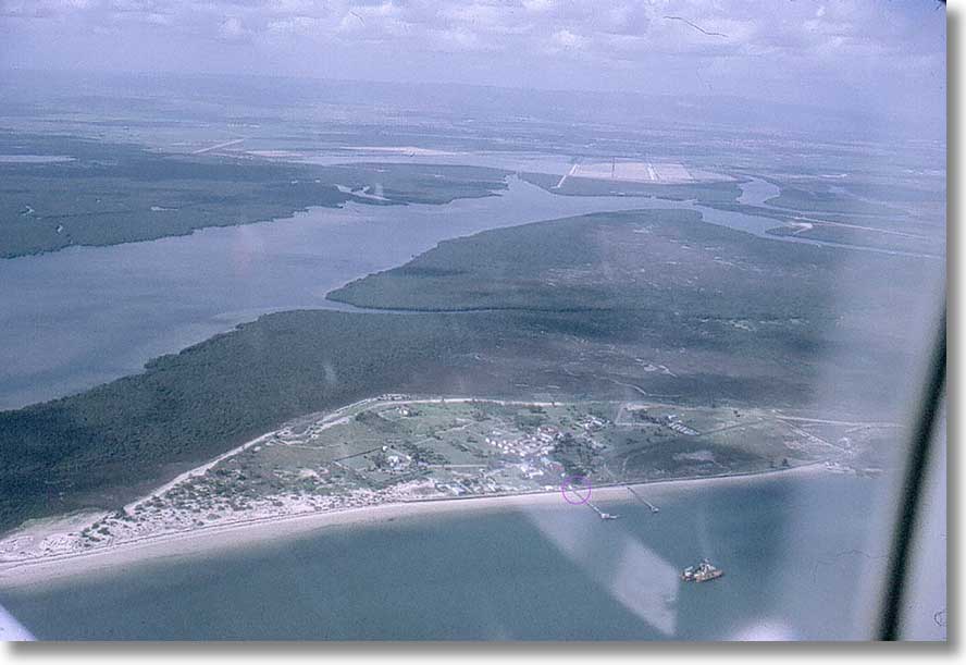
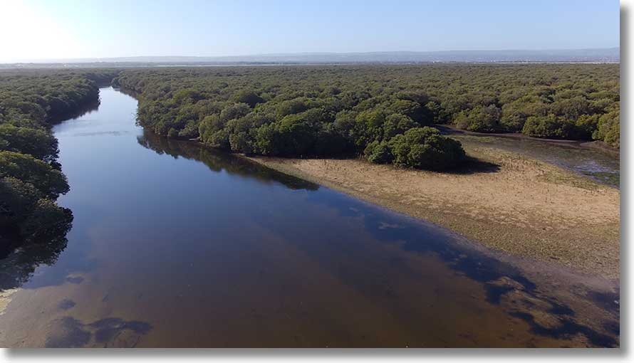
The Quarantine Station, still in use at the time. The two jetties were still intact and there were no mangroves along the shoreline. French Tom Creek is clear, but no mangroves on the Burrows Creek sandbar.
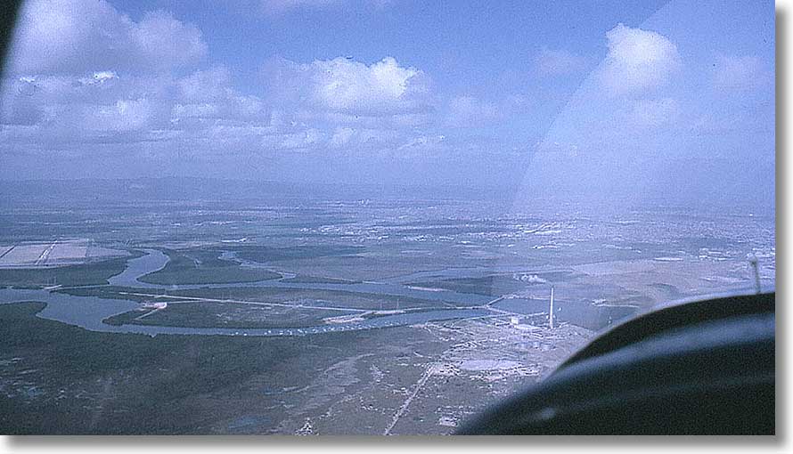
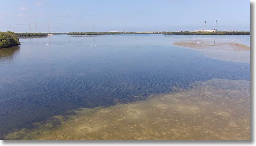
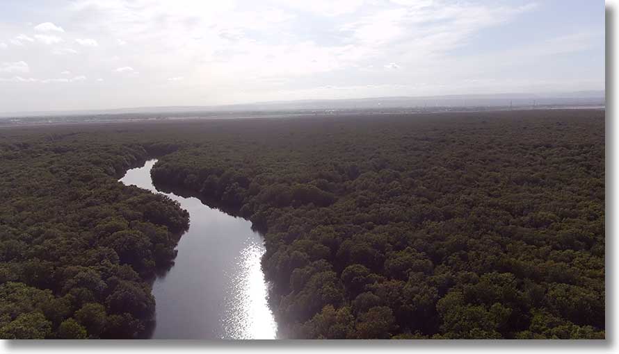
Garden Island: Torrens Island A in operation and moored vessels in Angas Inlet.
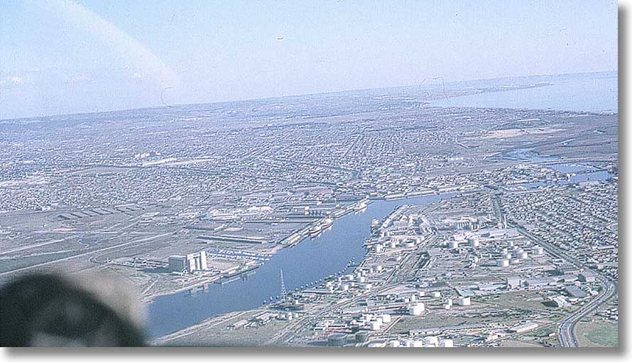
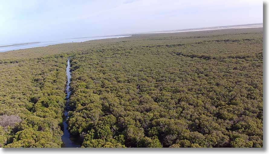
The Inner Harbour. At far right, the old Jervois bridge. Beyond it and the railway causeway what is now West Lakes, then a samphire swamp as far as Grange.
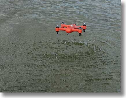
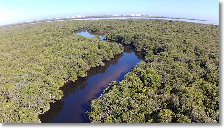
Now I’m flying a drone, a Swellpro Spry. It lacks the stability and hazard avoidance cameras of other drones but is waterproof, floats, and is able to take off from and alight on the water. A very different experience from model flying of years ago, and certainly from flying V-100, Pa-28, C-172, etc. Here it is hovering before setting down.
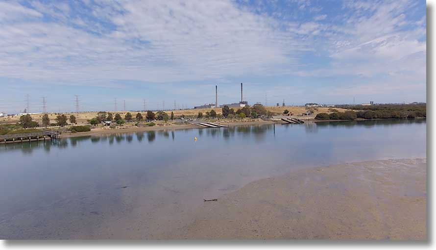
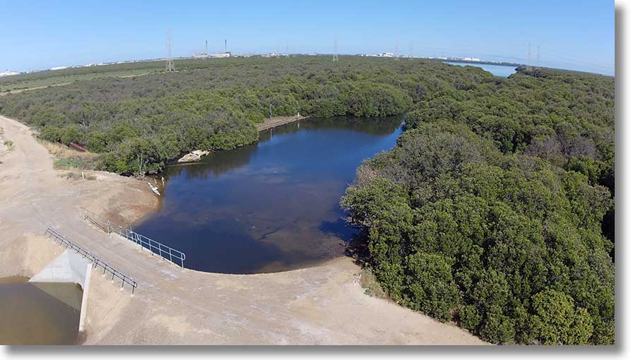
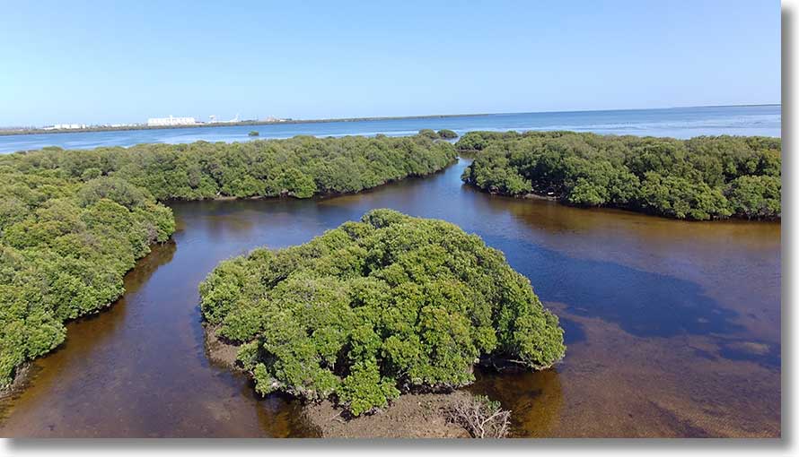
Angas Inlet
The Garden Island ramp area from across Angas Inlet. [Image date: 20190917]
Another view, with the boardwalk visible.
A closer look, on a quiet Tuesday. At weekends expect lots of traffic.
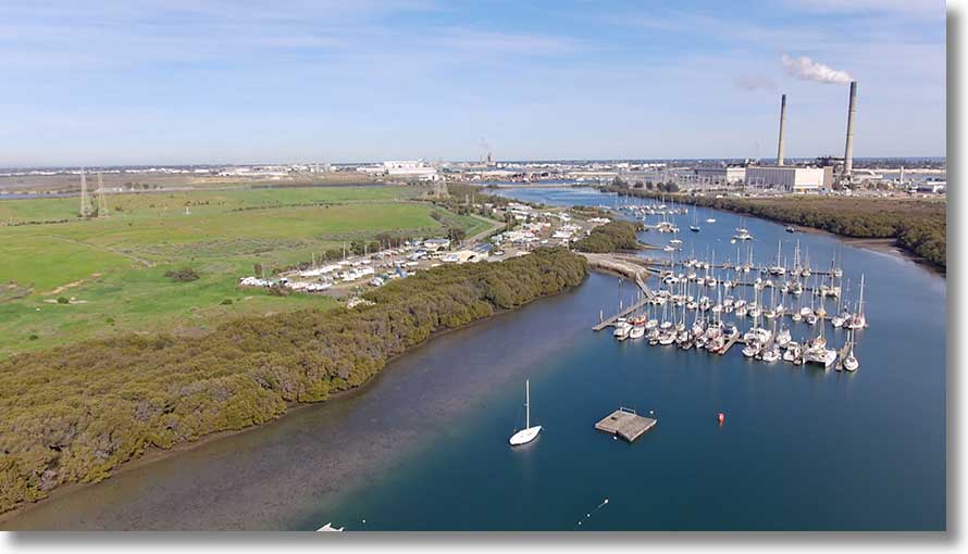
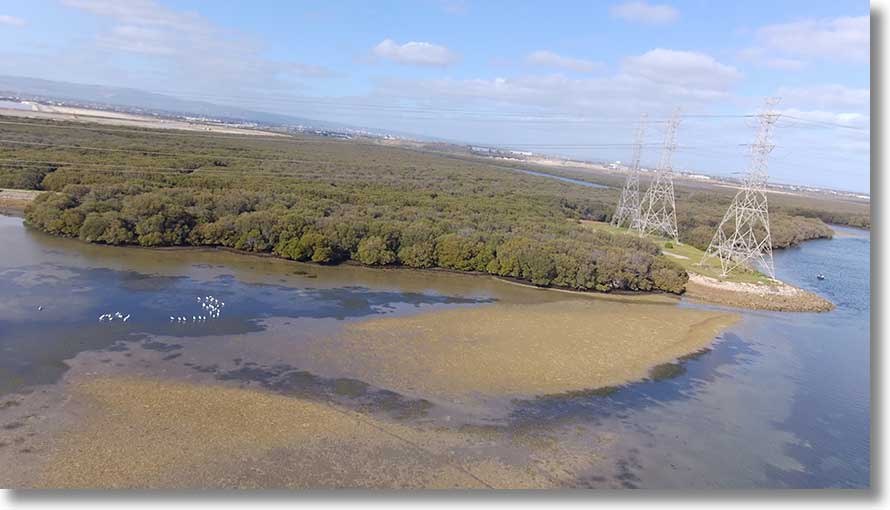
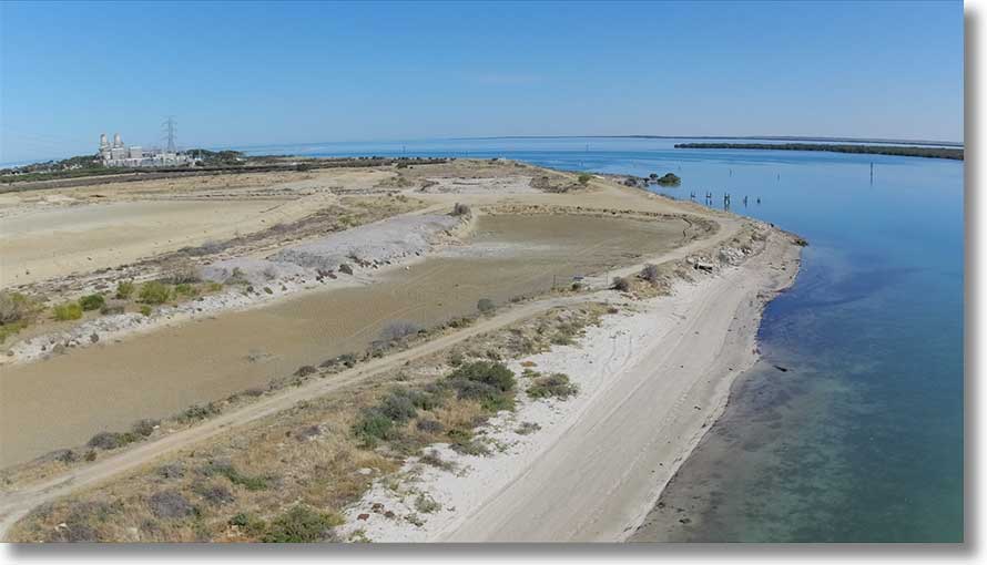
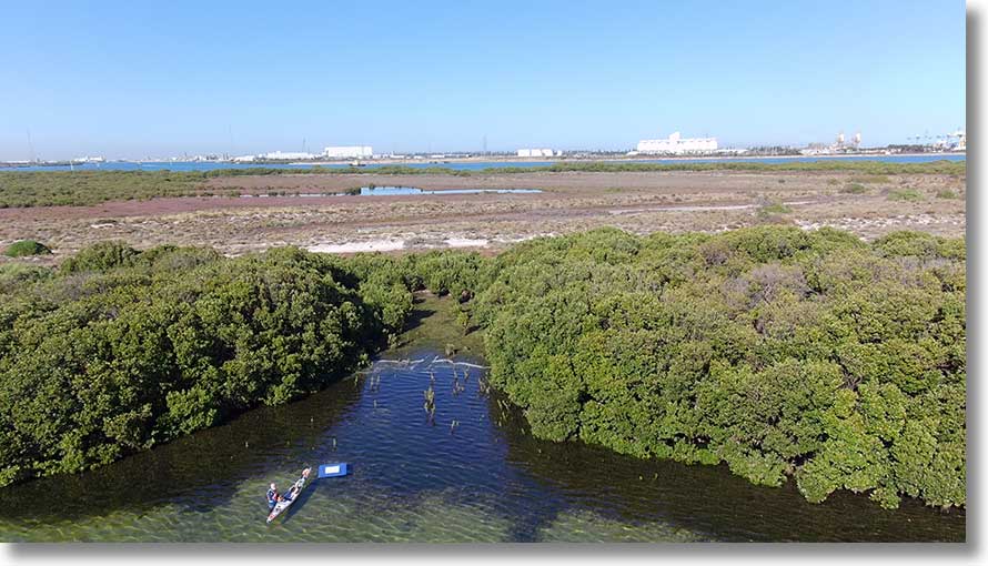
Angas Inlet from near Beacon 60, visible at extreme right. Also at extreme right is the entrance to the middle creek, and to the right of the power station, work on the new Barker Inlet power station.
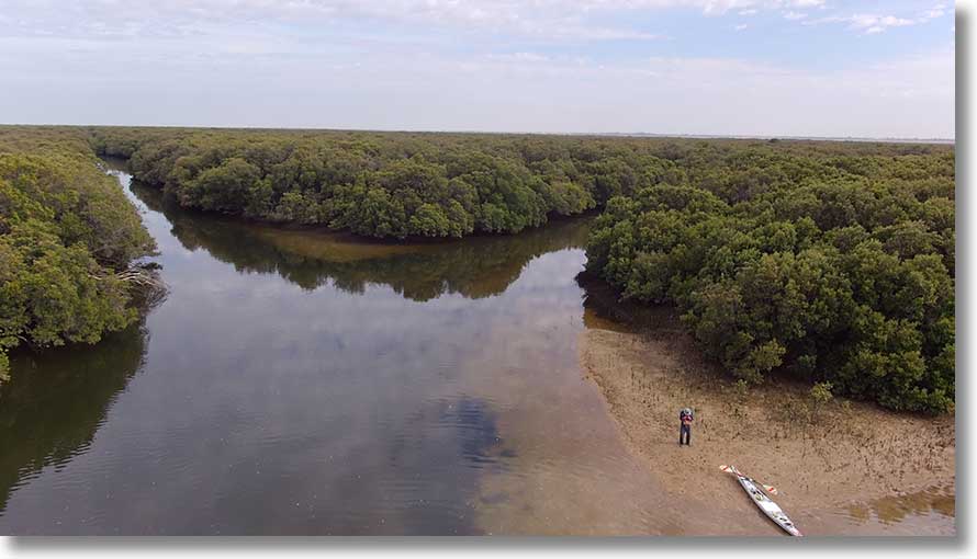
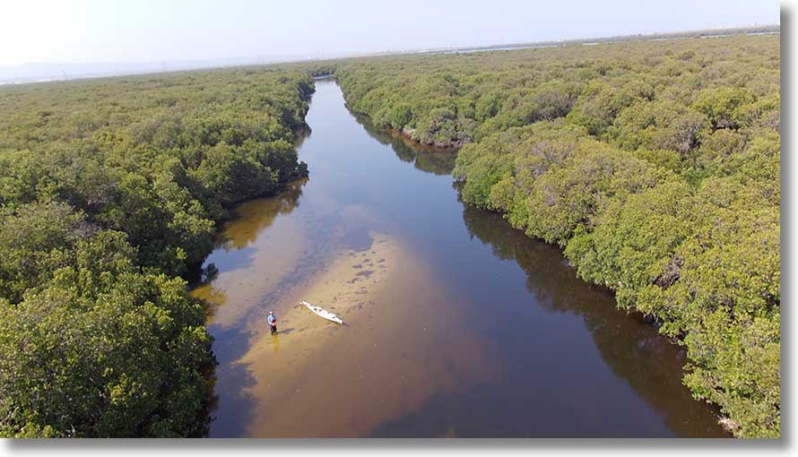
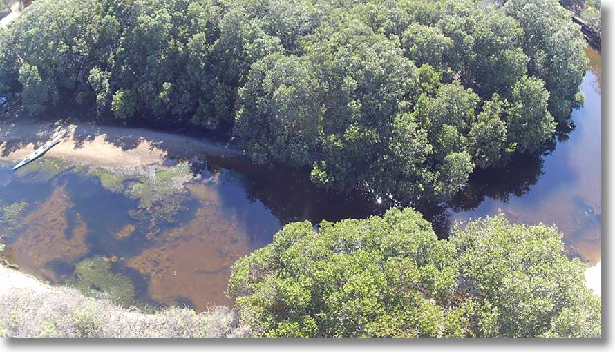
A closer view of the entrance to that creek. It can be paddled for some distance. [20200609]
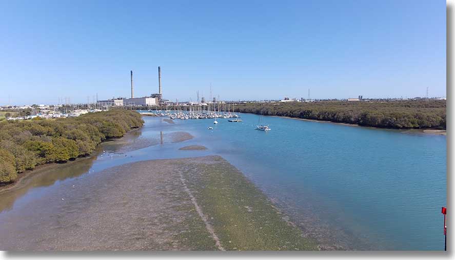
Garden Island Yacht Club has extensive marina and land-based facilities. Visible at right is the entrance to Jocks Creek, the western creek off the Inlet. [20200609]
The entrance to Jocks Creek, which can also be paddled for some distance. [20200609]
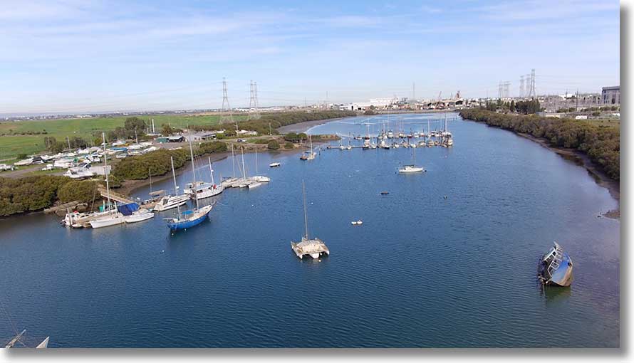
Also based in Angas Inlet is the Small Boat Club of SA. The derelict at lower right is recent, and is near some older remains. [20200609]
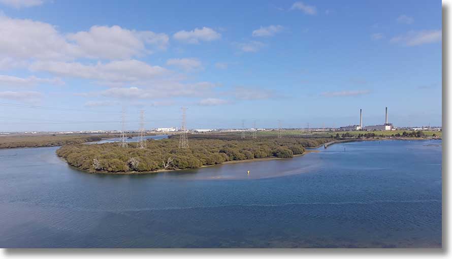
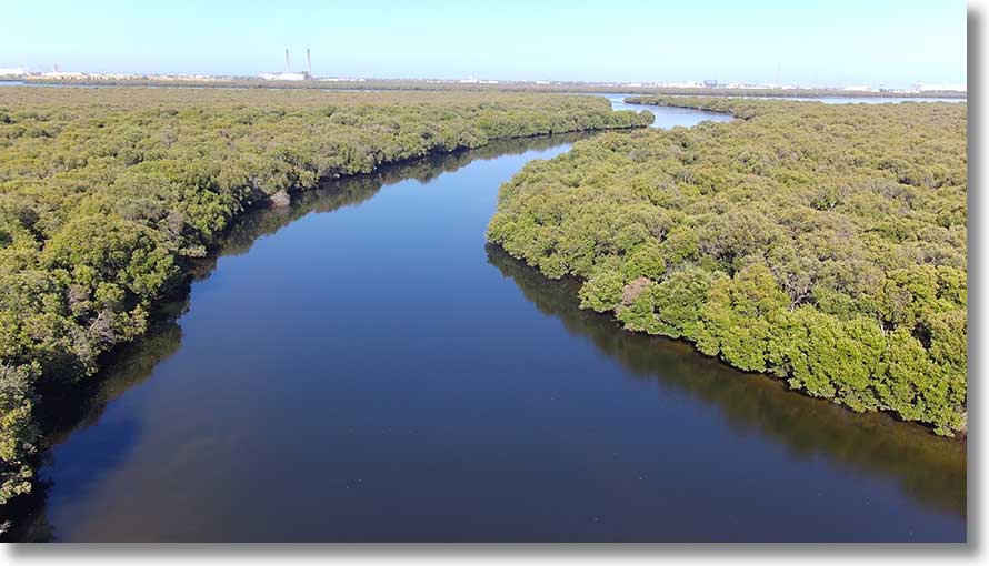
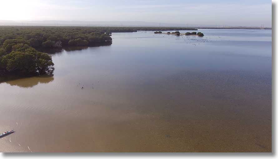
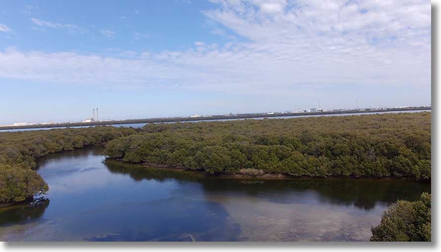
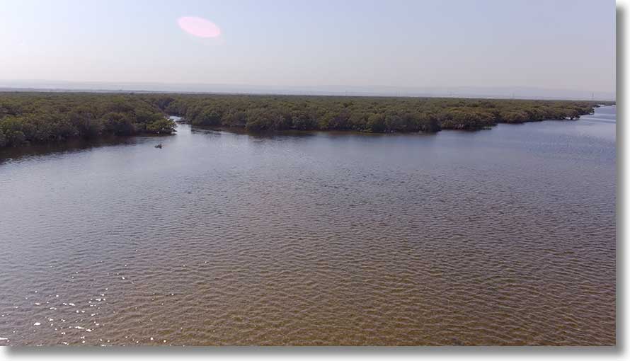
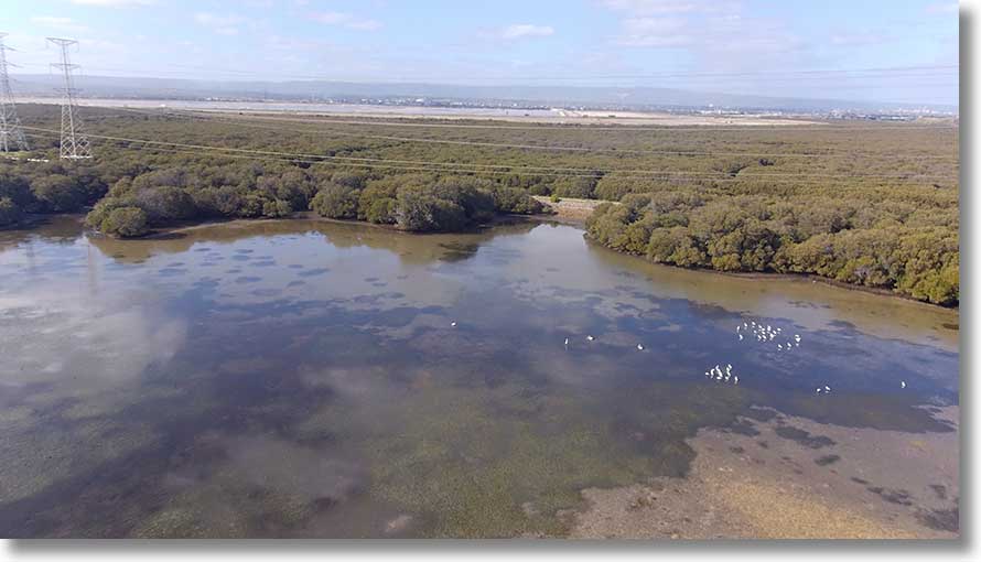
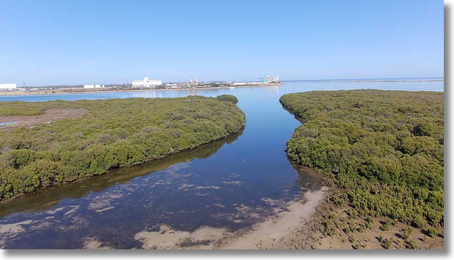
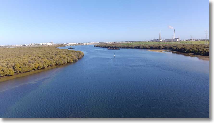
This is a view of both Angas Inlet and North Arm across Eastern Passage. [20200804]
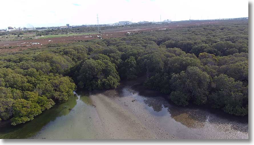
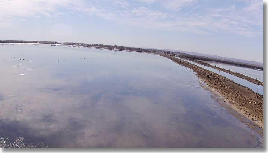
Broad Creek
At left, against the embankment, is the hulk used for explosives storage, at right of centre the wharf for unloading them. At centre, the remains of an abandoned trimaran. Lower left is the top of the rough, steep ramp. Attempt landings only at high tide. The pole in the water once held a measuring device for the Northern Connector project.
During 2020 a culvert was put through the embanmkent, connecting the creek with what had been a salt pan. Mangroves were cleared in the process. [20201124}
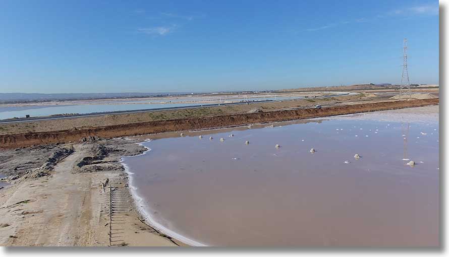
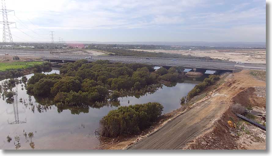
Looking roughly southwest, we see the abandoned salt pans, with the Northern Connector under construction. The vehicle right of centre is on another embankment.
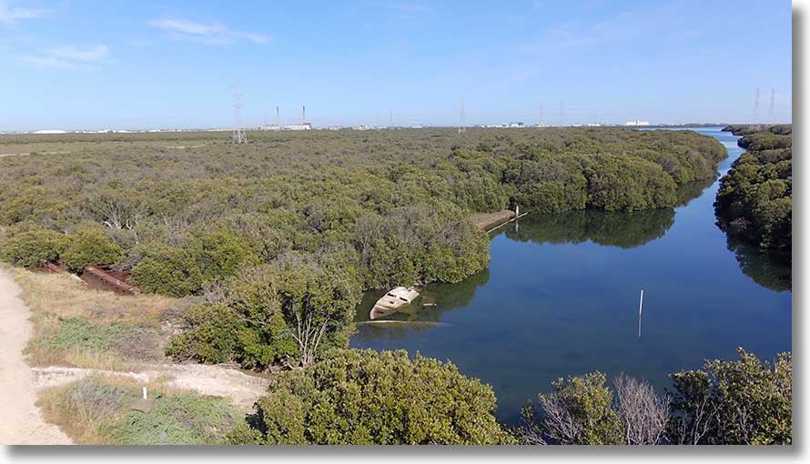
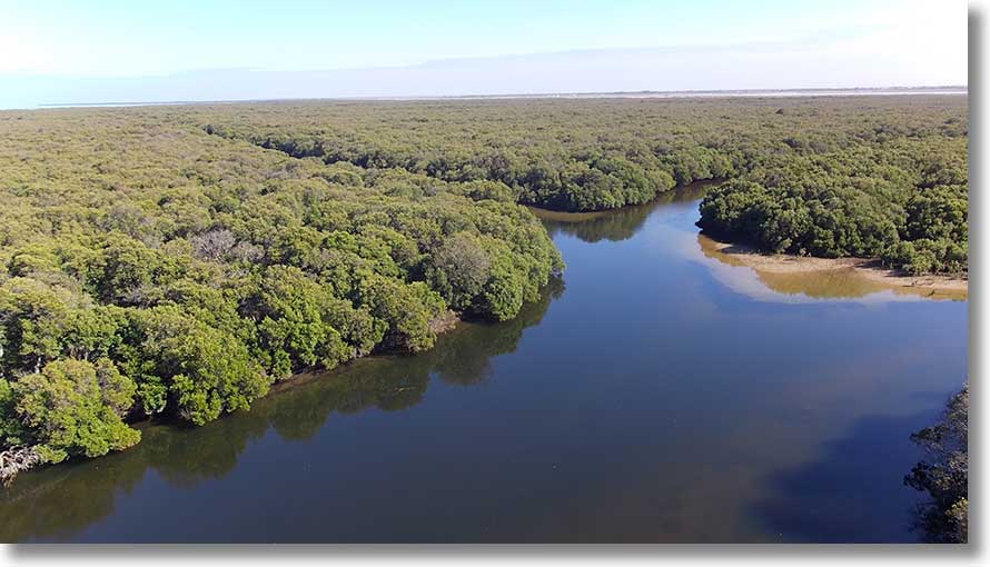
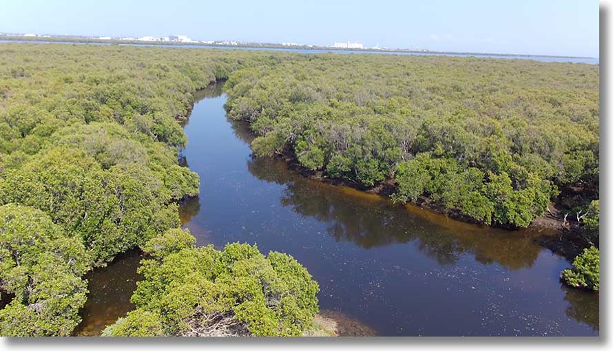
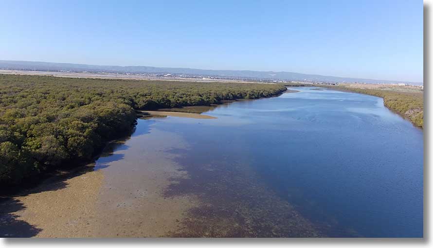
This is the view looking upstream from Barker Inlet. Follow the old channel marks to avoid shallows.
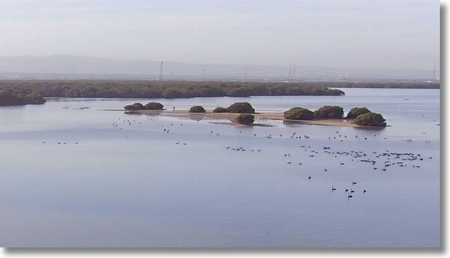
There are extensive sandbars near the entrance to Broad Creek, often covered with birds. Angas Inlet is in centre background, North Arm off to the left.
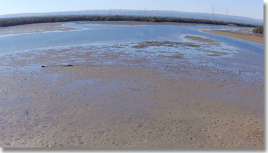
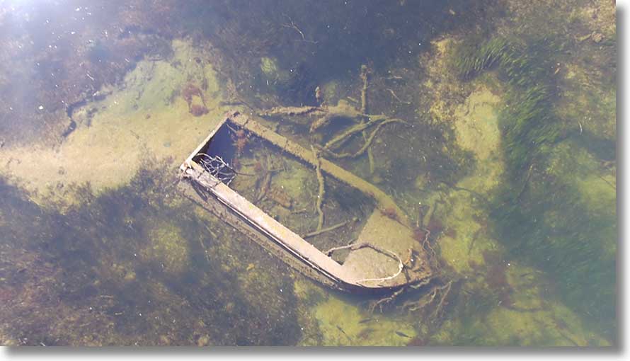
On one sandbar lie the gradually disappearing remains of an unidentified boat. Small dark objects are razorfish shells: sharp and scratchy. [20240507]
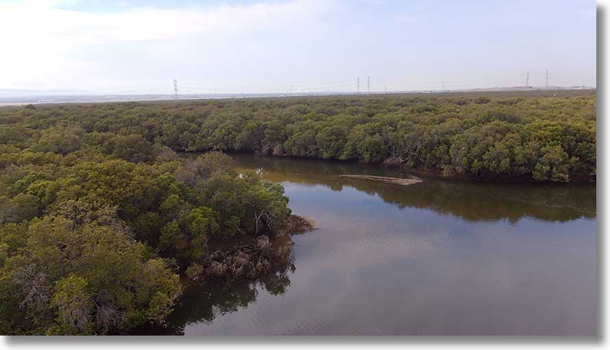
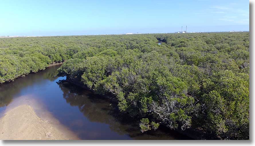
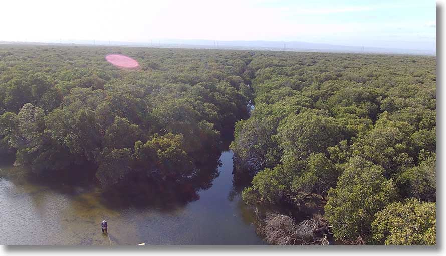
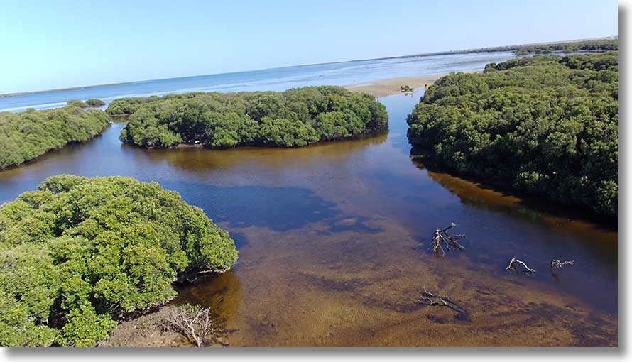
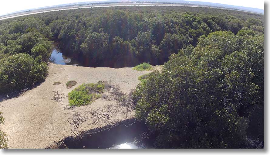
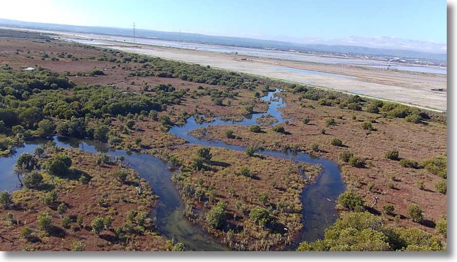
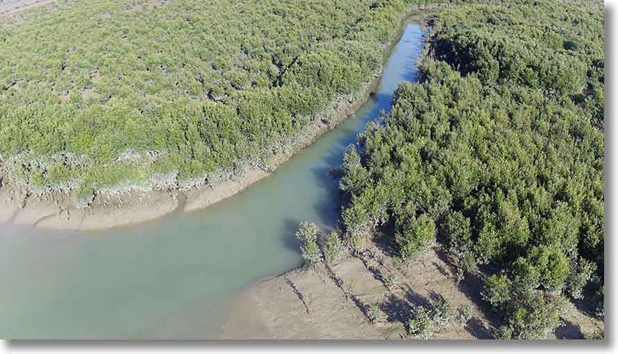
Swan Alley Creek
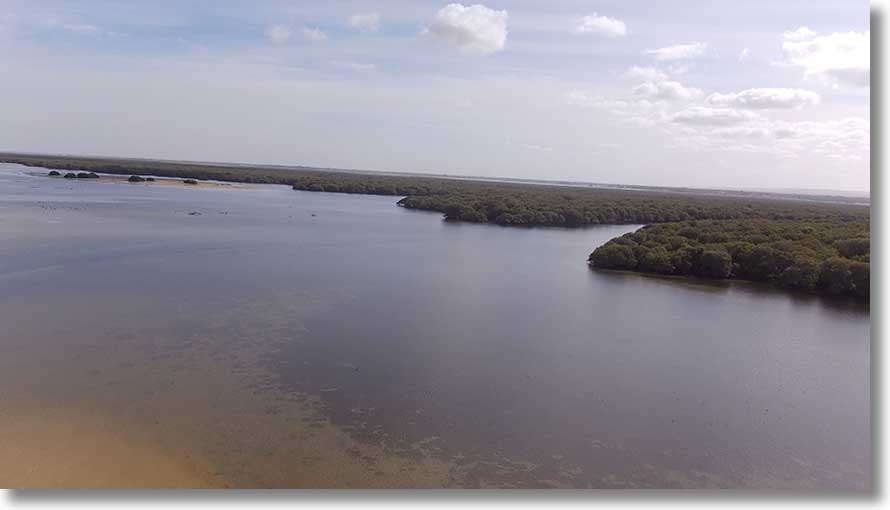
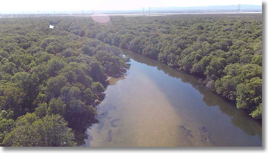
Swan Alley Creek is a large creek with a number of branches, plus the embankment channel, one part leading north west the other to the east. The entrance is wide and open, with a channel leading to it between the sandbars.
About 300 metres from the entrance from Barker Inlet is a sandbar, extensive at low tide.
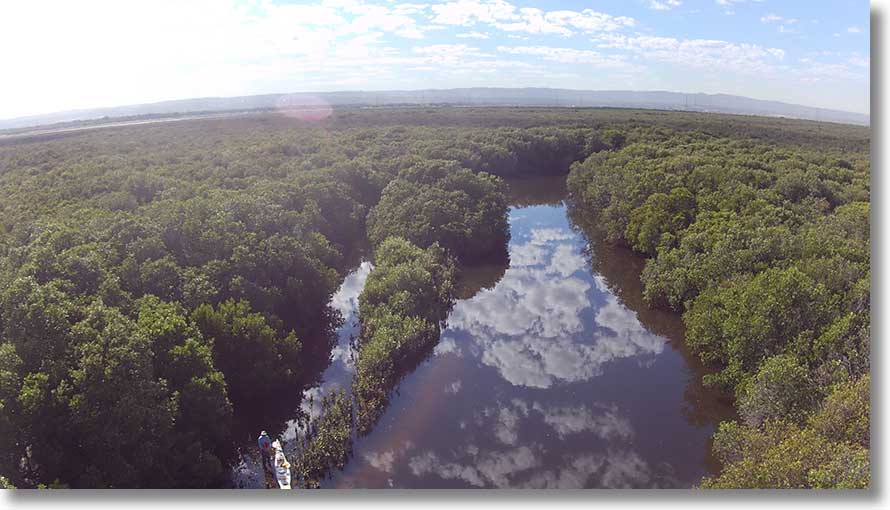
In this view, the main creek is at left, a side branch at right. (It can be paddled for about 1 kilometre but does not reconnect with the main creek. More about it below.)
This image was taken on 23 December 2019: note the smoke from the Cudlee Creek fire at top right.
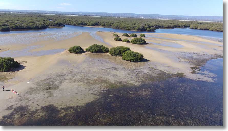
Opposite the sandbar is the entrance to a small creek leading to the area south of Burrows Creek. Most of the sandbar visible in the foreground dries at low tide.
Looking towards Barker Inlet from the confluence with the embankment channel and Shooting Creek (at 769 474). The southern end of Torrens Island is just visible at far left.
At the confluence there is, now being overgrown, a small beach. In this view, the embankment channel is to the left, Shooting Creek to the right. Shooting Creek can be paddled for some distance.
Another view of the confluence, taken 6 January 2020. Off to the right is another section of embankment channel. About 500 metres along the channel from this point is the entrance to another creek, and farther to the east several channels of the Little Para River.
The embankment channel leads to Burrows Creek and beyond. Don’t try it at low tide.
The main Swan Alley Creek, leading to Dry Creek. What appears to be a sandbar right of centre is floating debris.
Another view. (Flying early morning to take advantage of light winds means low sun angles...)
At the upstream end, the creek opens out to a pond where it is joined by the Dry Creek drain. The creek can be seen from the centre of the image off to the left. [20200728]
The Northern Connector now crosses the creek and drain junction, and an embankment (with pipes beneath) blocks access. There was once a flume (elevated channel), part of the salt pan system, across the area: part of it can be seen at right. Several years ago it was replaced by plastic pipe, seen alongside it. The remains of the flume extend for some distance southwards. There has been recent work on the embankment in the foreground. [20200728]
Shooting Creek
As noted above, Shooting Creek can be paddled for some distance from the confluence with Swan Alley Creek. About 500m upstream is a mid-stream sandbar. The pic was taken from above the sandbar looking towards the confluence.
Southern Branch
As noted above, the southern branch of the main creek, leading off at 765 473, extends for some distance but its upsteam end does not connect with the main channel. This and the next two views were taken from about 769 471. [20210311]
This view is towards Barker Inlet, with the main channel visible at upper right.
The branch extends to the east, eventually petering out. The small embayment at right leads nowhere, but there is a creek entrance to its west, just out of the picture.
To the north, the main channel can be seen, with its intersection with Shooting Creek, etc. at top right.
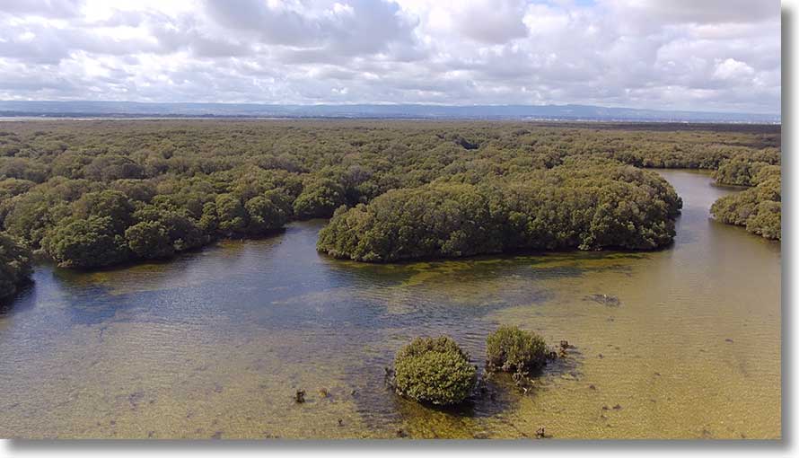
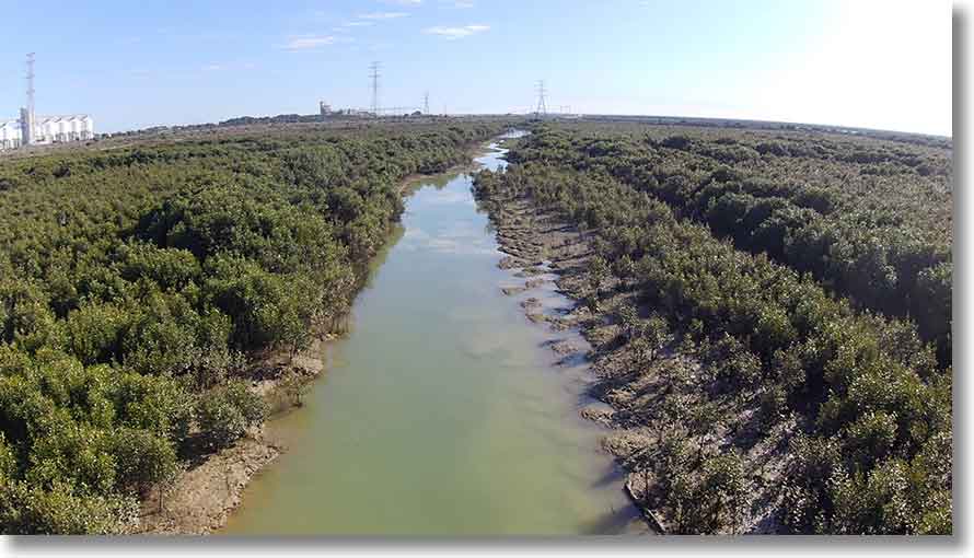
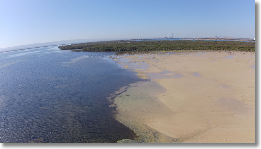
Burrows Creek
The entrance to Burrows Creek is behind the sandbar: the southern approach is the better choice. Both are blocked at low tide. This view is towards the entrance, from above the intersection of the creek with the embankment channel.
In the opposite direction: from over the mouth. [20200604]
This is the view upstream. The creek can be paddled for some distance.
To the north the embankment channel leads to Post Creek...
...to the south, to Swan Alley Creek.
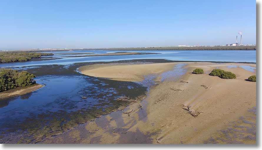
Upstream at 0276993 6148545/34° 46' 51.3"S 138° 33' 46.3" E is a sandbar, once large enough for a group lunch break but now overgrown. This is the view to the east, downstream. [20220131]
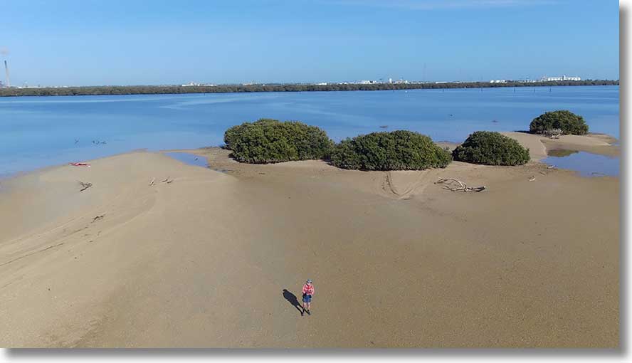
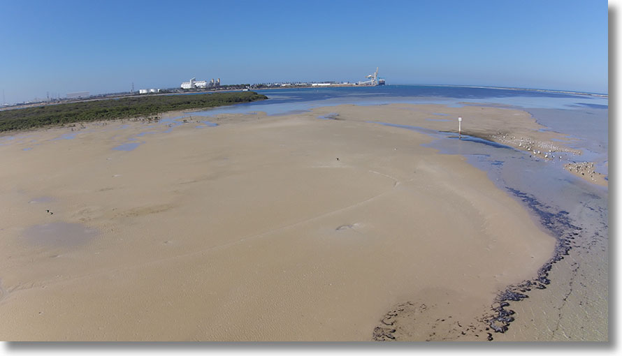
Burrows Creek sandbar
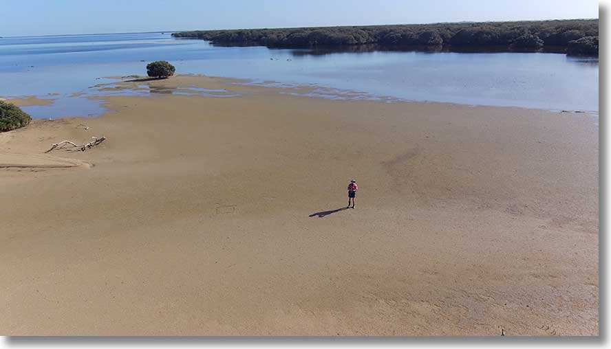
Somehow the extensive sandbar at the mouth of Burrows Creek was left off the map. Here’s the view from just west of the sandbar, looking to the east, towards the creek. (This image was taken on a different day from the others.)
To the north are Post, Garnets and Barque Creeks. Just visible is the isolated mangrove near Barque Creek.
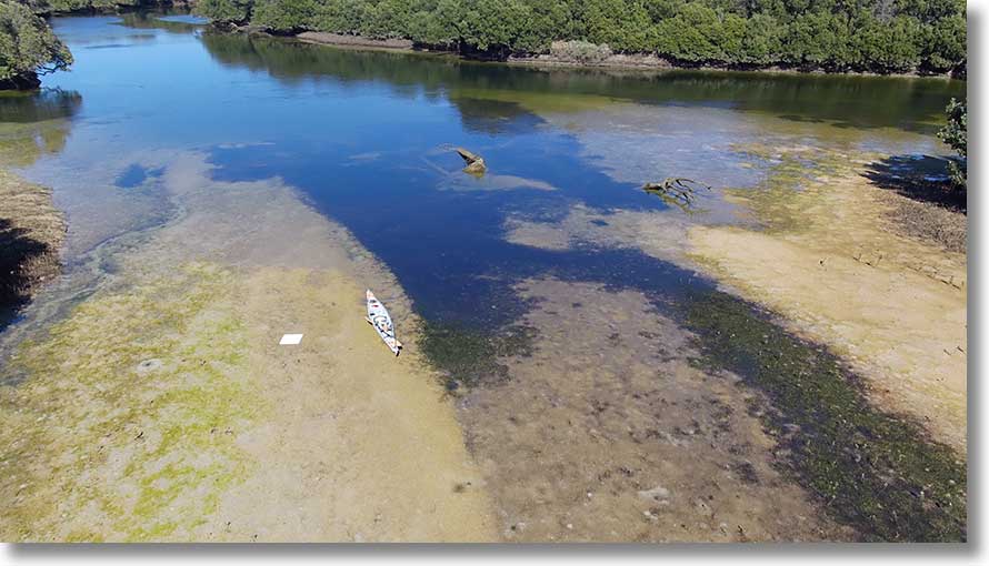
Look closely to the upper right to see the Middle Ground Inner beacon and the yellow speed buoy in this view to the west. The parked kayak is also visible.
Looking south from above the mouth of the creek at low tide. Note the scour and deposition patterns on the sandbar. [20200604]
A cropped view from the Post Creek entrance. Note the swans.
Post Creek
The entrance to Post Creek is fairly easy to find, in the inlet visible at left. Keep to the channel between sandbars at low tide.
At the intersection of Post Creek and the embankment channel there is a wide open area. In it lie the remains of a launch, not listed in the shipwreck collection, partly uncovered at low tide, completely submerged at high tide. Landing is possible at low tide on sandbars.
At extreme left is the embankment channel, leading to Burrows Creek, next is Post Creek, and at right is the embankment channel to Garnets Creek.
The straight channel is the embankment channel, with Post Creek off to the right.
An aerial view of the remains. It was apparently a net tender for fishing.
Garnets Creek
Set back among the mangroves, the entrance to Garnets Creek is not easy to spot from a distance. This view is southwards.
About 600 m from the entrance is the intersection with the embankment channel, with Post Creek some 500 m to the south. At low tide the sandbar is quite extensive.
The view out to Barker Inlet. Apparent channel at lower left is a gap in the embankment, and at far right is the blocked channel to the north. In the opposite direction, Garnets Creek can be paddled for at least a kilometre.
Barque Creek
Barque Creek is the northernmost easily accessible creek. Unlike the others, it has a number of entrances. This is the main one, with a channel across the shallows. Keep to the right (south) of the small island and follow the right-hand channel.
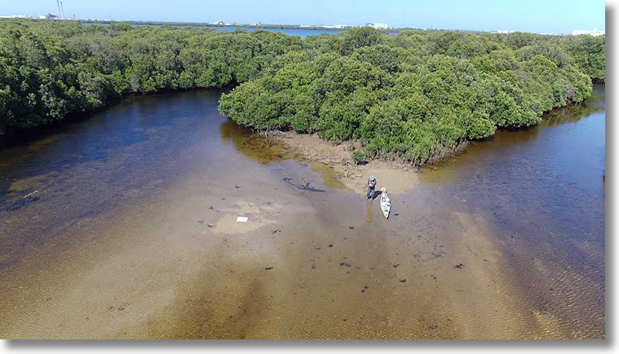
This is the view to the west within Barque Creek. The drone‘s approximate position is shown by the red + in the map fragment.
This higher level view shows the usual entry with small island at the entrance. There is a channel across the shallows to Barker Inlet, the only access at low tide.
The main channel is to the east, and turns southwards. Upstream is the intersection with the embankment channel.
This view is to the northwest...
...and this to the north, showing two entrances, with sandbar across the area.
Thes following pictures are from just to the north, this looking westwards.
Looking southwards, we see at right one of the entrances. At far left is the original mouth of the creek to the north of Barque Creek, diverted by the embankment.
To the north of Barque Creek there are only very small creeks as far as St Kilda.
The next two images are from a short distance upstream of the intersection of the creek and the embankment channel, a large open area.
This view is westwards, with the creek and channel intersection above left of centre. [20210406]
To the north east, some open areas in the mangroves are visible. They are inaccessible. [20210406]
Farther upstream at 34°46'07.7" S 138°33'27.3" E/765499 are two loops. (Gridlines on the map fragment have been enhanced.)
The bare ground of the eastern loop, covered with mangrove pneumatophores. Give it time, and there may be a cutoff. [20211230]
The southern end of the eastern loop. Note the sandbar, usable at low tide. [20211230]
Isolated mangrove
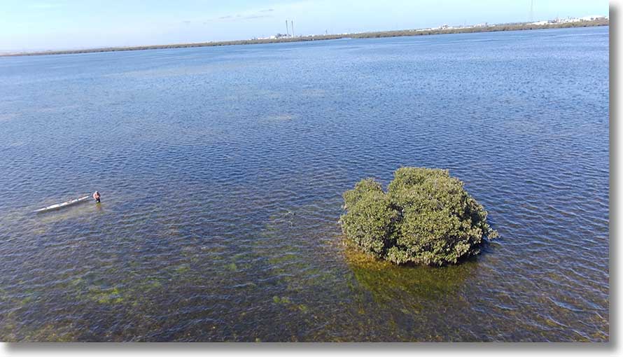
Out from the entrance to Barque Creek, at 34°46'01" S 138°32'23.5" E/74855 49793, is an isolated mangrove. This view is to the southwest, with the entrance to French Tom Creek visible in the distance to the right of Torrens Island power station.
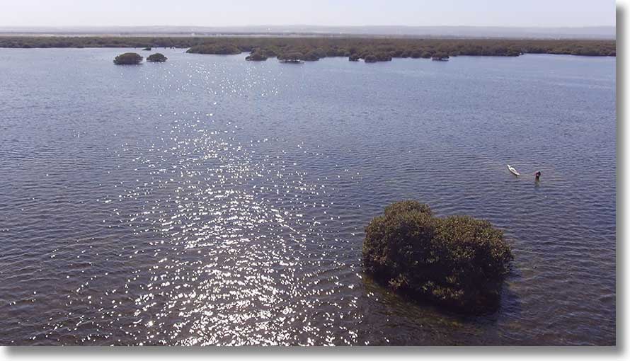
This view shows the tree‘s position relative to Barque Creek, with its usual entrance in the inlet at the right.
‘Hidden Creek’
So named because its entrance is not easy to spot at 34° 48' 30" E 138° 32' 55" S/75758 45505, this creek meanders southeastwards towards the boundary embankment, where this picture was taken. Unlike other creeks, it can be paddled to where it opens out to a samphire flat, although mangroves are spreading across the area. At high tide, above 2m, it’s possible to paddle to the embankment, then southwest along the embankment to another creek exiting in North Arm Creek, or northwest to the powerline causeway.
This is the view looking back toward the embankment from the edge of the mangrove area. [20200716]
From this point the creek meanders through mangroves towards the top left, with its entrance beyond. [20200716]
To the north east of the creek there is a pond, accessed with difficulty (and usually some pruning) by following the the original course of the creek and then powerline causeway. (Note the powerlines across the top of the image.) Kayak position is 34° 48' 24.3" S 138° 33' 11.3" E/76171 45657. [20200716]
The proximity of the powerlines makes aerial views of the entrance to Hidden Creek difficult. The entrance is through the trees beyond the rightmost pylon, and the channel then goes around and along the causeway as far as that bare area at left. [20200804]
Before the powerlines, that bare area was the original mouth of the creek, which can be seen meandering southwards. The pond in a previous image can be seen between the bare causeway and the pylon to the left. [20200804]
North Arm Creek
North Arm Creek is wide and shallow: you need a tide level above 1.0m to avoid running aground. Seen here is the view from above the intersection with North Arm. Left of centre, beyond the sandbar, is the entrance to a small creek. Just visible in the distance is the overpass, part of the Northern Connector system. [20200605]
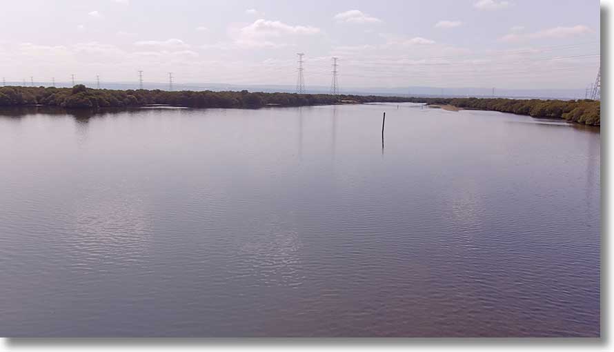
This is the view from near the upstream end, with North Arm in the distance.
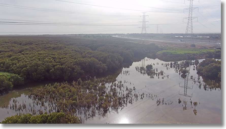
The Northern Connector crosses abandoned salt pans to the east of North Arm Creek...
... after crossing a bridge near the upstream end of the creek.
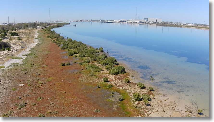
Above the southern side of the creek is the Wingfield Waste and Recycling Centre, where four main businesses recycle paper and cardboard, green waste, building and demolition waste, and residual waste. [20230926]
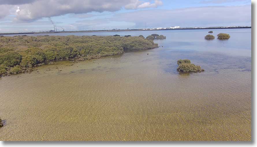
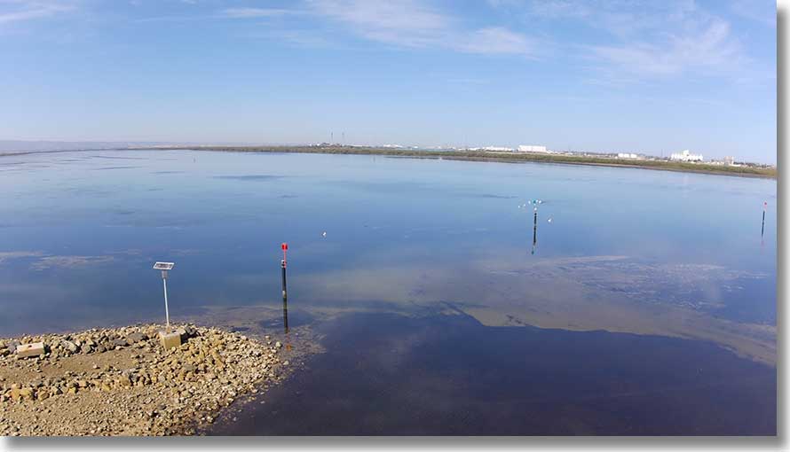
Middle Ground Inner beacon
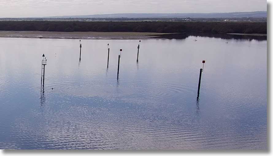
The boating channel in Barker Inlet is mrked by a series of channel marks from the Black Pole into Angas Inlet. At left in this view is the Middle Ground Inner mark with its light (Fl. G. 4s), with the entrance to Post Creek in the background. Northwards from Beacon 35, the mark with triangular topmark at top left, boat speeds are not limited: to the south the 7 knot limit applies. [20200706]
This view is towards the Burrows Creek sandbar, and includes the Dolphin Sanctuary speed reminder buoy. [20200706]
French Tom Creek
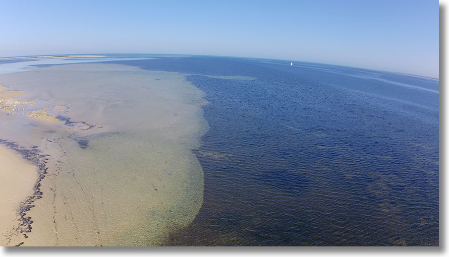
French Tom Creek is the largest creek on Torrens Island, with a large sandbar on the northern side of the entrance.
Grey structure in the centre of this view northwards is the Pelican Point Power Station.
On the western side of the island is the Quarantine Station, with buildings visible among the trees in this cropped view. Grey structure to its left is the gas turbine Quarantine Station Power Plant.
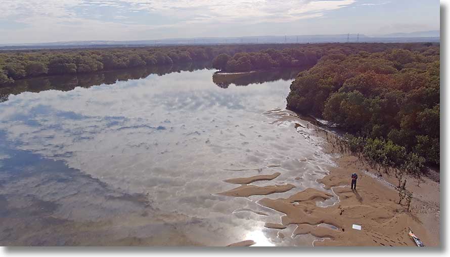
At the upstream end the creek splits, with the main channel across the bottom right of this view. Landing is possible at high tide. (Watch where you put your feet.) [20200731]
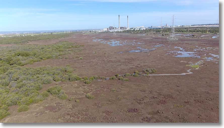
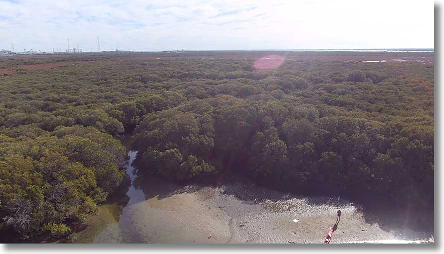
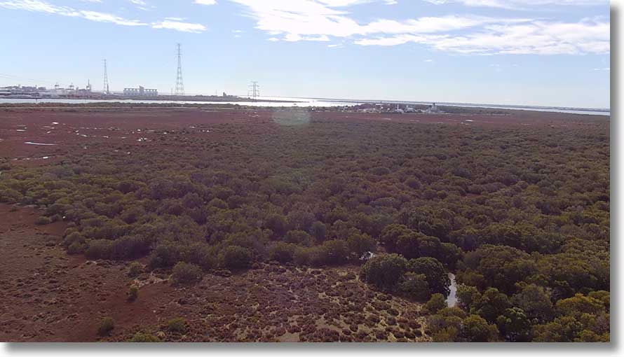
Most of the interior of the island is samphire swamp. This is the view to the south, towards the Torrens Island and Barker Inlet Power Stations. [20200731]
To the north are the Quarantine Station and the nearby Quarantine Station Power Station. [20200731]
Mutton Cove
At the end of a potholed track off Mersey Road North is a rough parking area and a small beach. This is the view southwards, with the Quarantine Station across the river.
The beach is useful if you want access to the nearby area, but it is without facilities.
In the opposite direction is Pelican Point, with its power station. Point Grey is the northern point of Torrens Island.
During 2020 the Snapper Point Power Station, incorporating gas turbines currently housed at Elizabeth, is to be built in the area from north of the Pelican Point station to a point about centre of this image, at the end of the line of vegetation. Bare areas bounded by embankments were used to dump dredge spoil.
Across the river, centred on the single mangrove at extreme left is a small beach, the northernmost landing on the island. The Quarantine Station is at right.
This view is from above that beach, with the single mangrove just out of view to the right. The Quarantine Station jetty is visible, and the shipyards on the peninsula side obvious.
The main attraction at Mutton Cove is the remains of Excelsior, just south of the entrance track. Note the walking trail, with interpretive sign, in the foreground. [20230515]
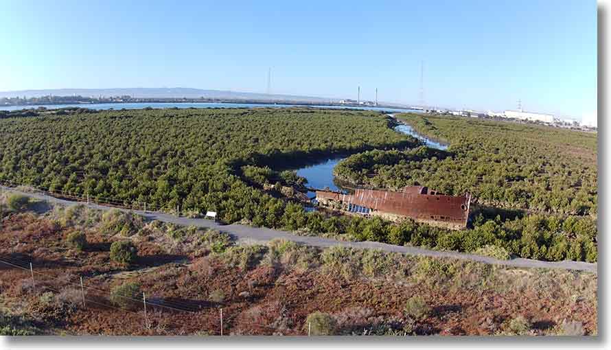
Mutton Cove Creek can be accessed through a break in the embankment at 724 486. At 724 489 a branch leads off to the west, with the remains of Jupiter buried among the mangroves.
This is the view to the north from the junction. Note that you’ll need a high tide to paddle that stretch towards Excelsior, and the mud in the area is very soft.
This view is to the South, towards the entrance...
...and this towards the west. The side creek can be paddled, as can be another on the eastern side farther north.
“Two small beaches...”
The notes on the back of the map refer to two small beaches near the northern end of Torrens Island, at 729 509 and 732 507. Both are now overgrown by the ever-expanding mangroves and are unusable.
This is the northern of the two. What appears to be solid is floating seagrass wrack over mangrove pneumatophores, making landing impossible. Look closely to spot a tug in the Port River, and very closely to spot the ‘Torrens Island Conservation Park’ sign just beyond the bare sand area.
The view to the south shows part of the extensive clear area behind the mangroves, now inaccessible.
The Cutting
The Cutting was once maintained as a passage for explosives vessels on their way to Broad Creek. It is now shallow: you will need a tide level at least 0.93m. As I calculate the tide when this image was taken it was at 0.93m but I suspect it was rather lower, given the High just to the east. Look closely and you’ll see several scrape marks. Vessel at the container berth is the Al Hilal, IMO 9349552.
The view southwards over the clear area to the Port River.
Point Grey
The northernmost point of Torrens Island is Point Grey, and the area to the north and west is shallow. Much of it dries, and is known as the Section Bank. Part of it is a breeding area for pelicans and other seabirds.
Outer Harbor is the main container port for South Australia, and also has facilities for bulk grain loading from the white silos visible left of centre. Ship at the container berth is the GSL Christel Elisabeth IMO: 9280641. [20210108]
This view shows the Barker Inlet side, with the entrance to the Cutting just visible. [20210108]
To the east is St Kilda, with its entrance channel with its breakwaters. (Look closely to see one boat leaving and another entering.) Starboard mark left of centre acts as entrance beacon, mark to right of centre is Middle Ground (Outer) beacon (Fl. 2s 3M). [20210108]
This is the end of the northern breakwater, with channel marks. [20250414]
Looking along the channel, St Kilda in the distance, where there are a boat ramp and marina. Area in the foreground dries at low water springs. [20250414]
Entry to Barker Inlet from the gulf is past the Section Bank Pile Beacon (Black Pole), lost in the haze in this view. The yacht has some distance to travel to open water. [20210108]
Snowden Beach
Snowden Beach on the Port River is accessed from Willochra Street and George Robertson Drive. At far right is the boat ramp, with trailer park. Just left of the rightmost clump of trees is GTS Dolphin, the Girl Guide activities centre. In the centre is the Port River Sailing Club (dinghies), with car parks and access to the beach on either side.
The Port Adelaide Sailing Club (yachts) is housed in Marina Adelaide, whose entrance is above Beacon 44. At far left is the Adelaide-Brighton cement works.
North of Snowden Beach is North Arm, with its facilities for the fishing fleet. Farther east in North Arm are slips and vessel maintenance works, and beyond the bridge, the Ships’ Graveyard.
North Arm seen from the junction with North Arm Creek. In the centre is the isolated danger mark, beyond it, Santiago and, to the left, the Dorothy H Sterling. [20200605]
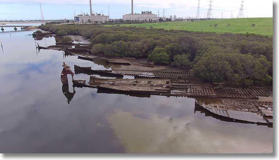
Ships’ Graveyard
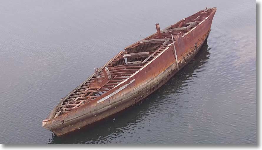
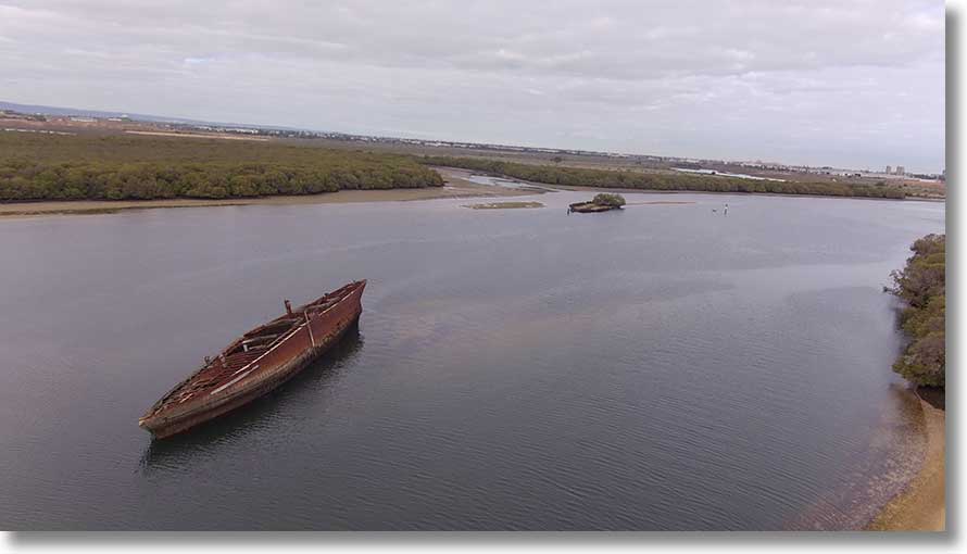
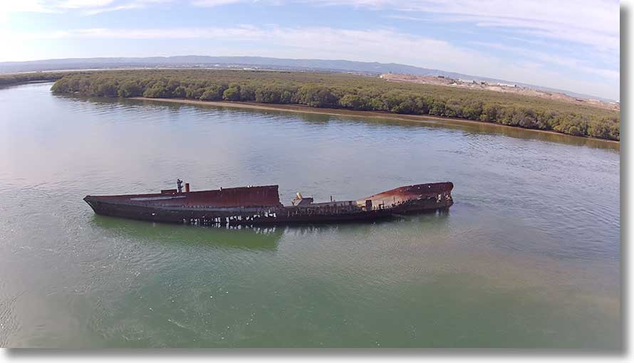
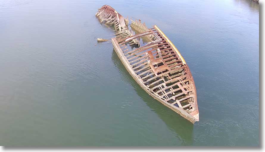
Oldest vessel in the Graveyard and last to be abandoned here is Santiago, built in Scotland in 1856 and placed here in 1945. It is an early iron ship. The first pictures were taken in May 2022, the second two on 4 April 2023 after the ship broke up in late 2022.
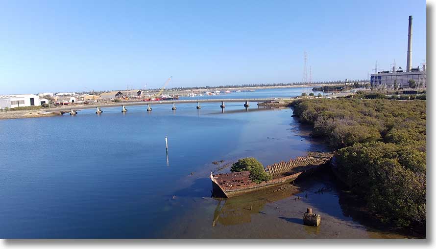
Across North Arm is the Dorothy H Sterling.
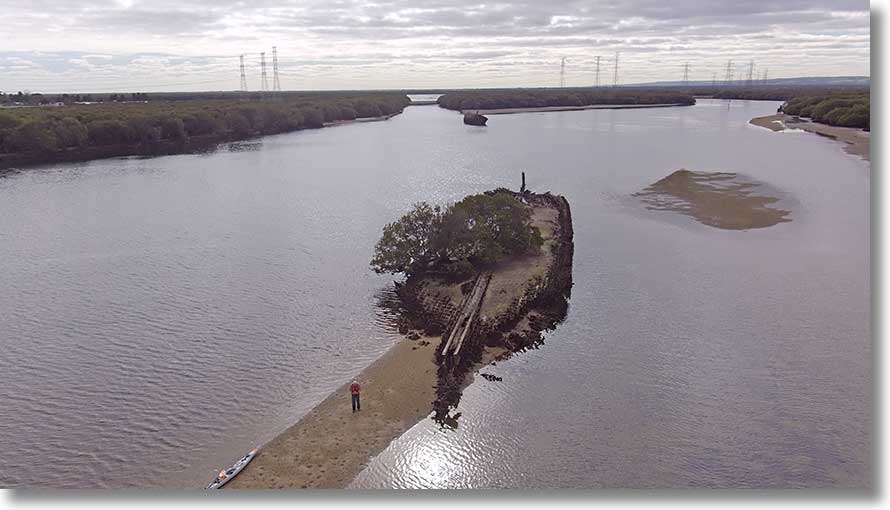
The Dorothy H Sterling was built in 1920 in Oregon in the US. Of timber construction with an iron keel, clearly visible in this view, it was a six-masted schooner. It was stripped of useful timber and placed here in 1932, a victim of the Great Depression.
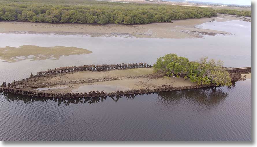
The ship is now a small island, colonised by mangroves and with its remaining timbers rotting away.
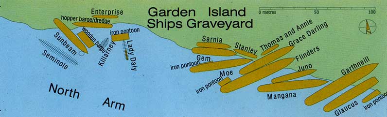
The main Graveyard is to the west. For reference, here is the layout plan from the map.
A prominent vessel is the Glaucus, with its sternpost and rudder still intact. It had been built in England in 1878, and abandoned here in 1935.
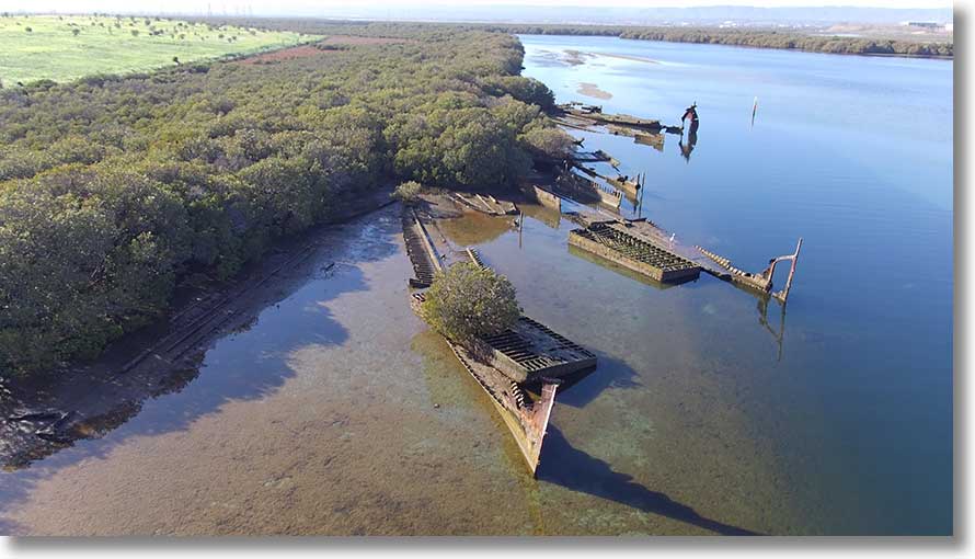
Nearest vessel in this view is Moe, with an unidentified barge on it. Look closely to see an egret on Flinders. [20200605]
Sunbeam is the large vessel in this view, with the boiler from Killarney nearer the camera. [20200605]
Torrens Island Quarantine Station
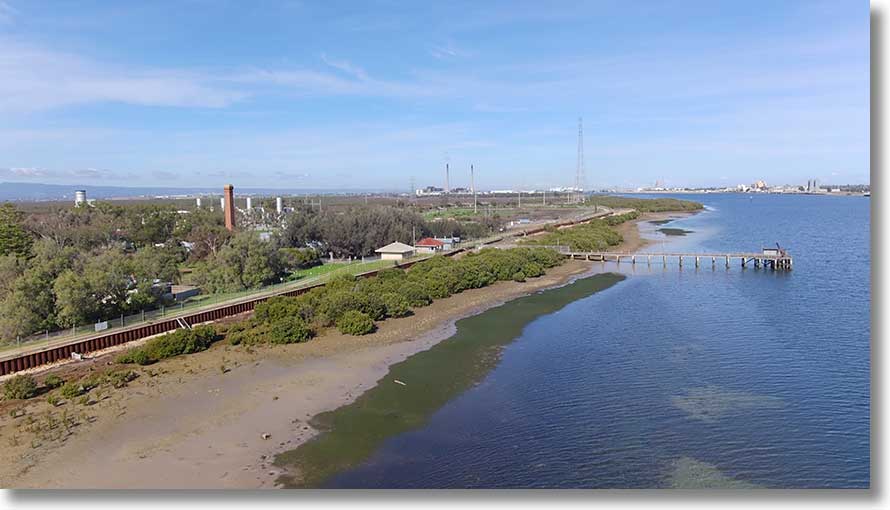
The Quarantine Station began, in tents, in 1855, with buildings opened in 1879. In the early 1900s it was expanded, and more buldings were erected in the 1950s. Until 1962 the only access was by boat, via the jetty. The Station closed in 1979, and is now the responsibility of National Parks & Wildlife Service (DEW).
The red tile-roofed building is now used as an office and workroom for teams maintaining the site. Most of the main buildings—waiting room, shower block, disinfection building with autoclave, etc—are hidden behind the trees. Building part-hidden at left is one of the houses for nursing staff. The red-brick chimney was used by the boiler, now removed, used to supply power and heat.
In the background, the Origin Energy Quarantine Power Station. [20200512]
This view is from north of the station, near the mortuary building. Red tile-roofed buildings at left were built in the 1950s. White building nearer the camera is the last remaining imported prefabricated accomodation building. Two-storey building is Refshauge House, used by the administrator and doctors. Building at right was for nursing staff. [20200611]
A view from the southern side, against the light. There is some overlap with the next image. [20240517]
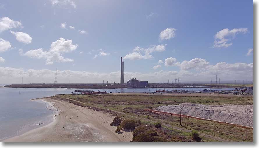
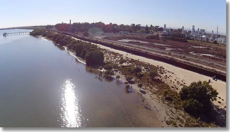
The Quarantine Power Station has five gas turbine generators, running on natural gas and producing up to 224MW as required on demand. Along with much of this stretch of the island, the beach in the foreground is gradually being taken over by mangroves: these trees have appeared in the past four years. [20240517]
St Kilda mangrove dieback
In late 2020 there was some publicity given to the dieback of mangroves to the south of the St Kilda township. Two ABC items from early 2021: Forest dieback on Adelaide's St Kilda Mangrove Trail under investigation in South Australia and Call for urgent action to prevent further dieback of Adelaide's St Kilda mangroves.
On 23 January 2021 the Save St Kilda Mangroves Alliance was formed to publicise the problem and call for action from the government.
The picture shows the brown dieback area south of the township, to right of centre in the image. [20210122]
Traffic
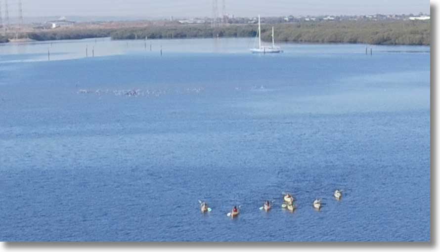
At times, the place can be infested with kayaks, some of whose paddlers have no clue as to the rules regarding PFDs, channels, give way, etc. This group was approaching Burrows Creek but found themselves running into the sandbar, so turned and went into Swan Creek instead. In the background, a yacht firmly aground on a falling tide after trying to navigate the tricky channel. Note also the flock of birds left of centre: mangroves are now sprouting in this area so expect a new island in a few years. [20220303]
Swans
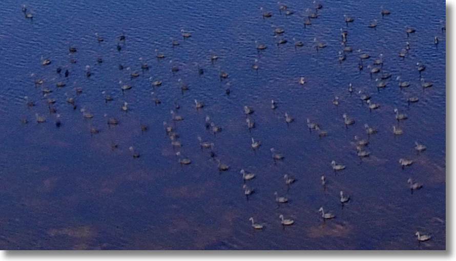
The shallows of the northern part of Barker Inlet are the haunts of flocks of Black Swans (Cygnus atratus). Those in the picture seemed unconcerned by the presence of the drone. Where possible, try to avoid disturbing them. [20210122]
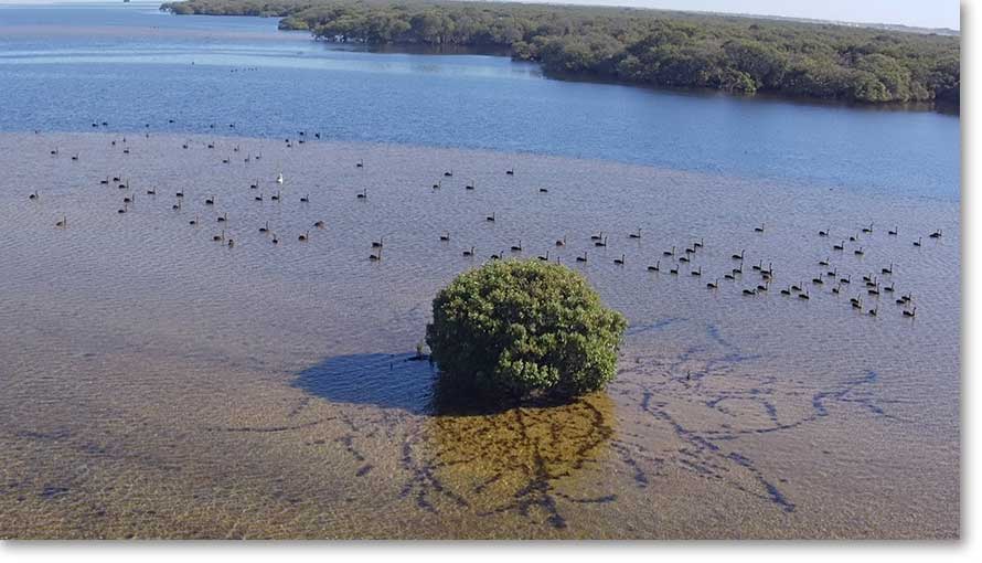
This group, with one Pelican, was on the northern side of the Burrows Creek sandbar. [20220303]
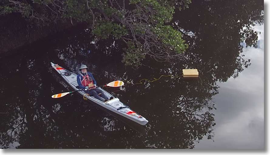
A selfie
I appear coincidentally in a number of images: here’s a deliberate selfie. The drone and controller travel in a wooden box on the kayak foredeck. The box floats and is used as the launch pad: in this picture it has drifted from its original position. Recovery is on to the water since the downdraft blows the box out of position. [20220315]