Notes on the Torrens Island and Environs map
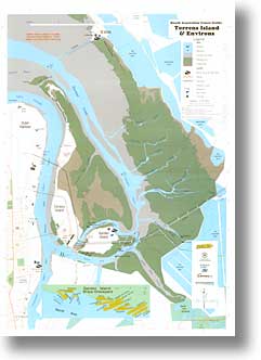
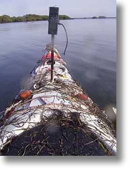
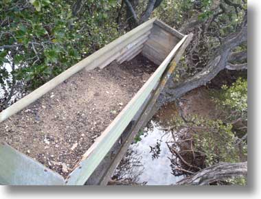
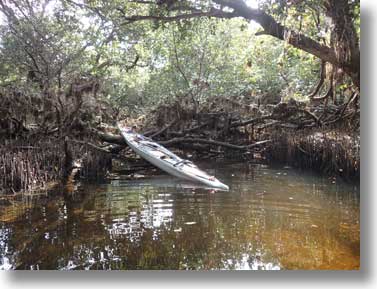
The Torrens Island and Environs map came about through the efforts of a number of people, particularly Anthea Shem (Office for Rec and Sport), Robyn Hartell (Heritage Branch of Dept for Environment and Resources), other members of the New Canoe Guides Committee, and Anthony Stephens (The Map Shop). I gave myself the job of surveying with GPS to provide fixes on key points, and made a number of expeditions into the area. (In the pic below, that’s the GPS unit on a mast on the sea kayak, which is covered in debris after burrowing through an overgrown creek)
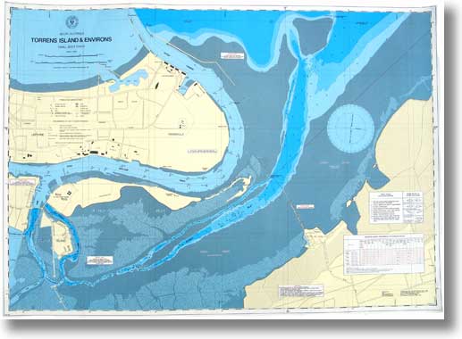
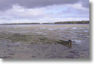
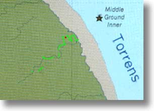
The area has not been mapped in detail in recent years. The 1:50 000 topographic map is lacking in detail, the 1982 DMH Small Boat Chart (below) does not cover much of the mangrove areas (and is long out of print), and other charts such as AUS 137 cover shipping channels only.
We originally intended to cover a greater area, from Bower Road to St Kilda, but decided to concentrate on the smaller area at a larger scale. The base map comes from the Fullers street directory, with mangrove and creek detail traced by Anthony Stephens from aerial photographs into the GIS. My GPS data was used to resolve some ambiguities, in fact one creek section is drawn entirely from GPS track data.
These notes are intended to supplement the text on the back of the map, which is necessarily generalised and limited, and in places out of date. Some grid references are six figures, others, from GPS, may have ten figures for greater precision. Several also have Latitude and Longitude.
Aerial views
Beginning in September 2019 I have begun photographing key areas by drone to give a different perspective of the area, one that can’t be seen from water level. It is a work in progress: images will be added and replaced as new ones are made.
Precautions
Make sure you have the tide times and a weather forecast before setting out. The tidal range at springs is over 2 metres, and at low water springs much of the area dries or is too shallow to paddle. Tides in Barker inlet are about 30 minutes later than at Outer Harbor, and in the creeks as much as an hour later. Weather conditions can affect the tides, low barometric pressure leading to higher tides, high pressure to lower. Westerly winds raise the sea level, easterly lower it. If you run out of water you may find the sand and mud very soft (and in many places very black and smelly).
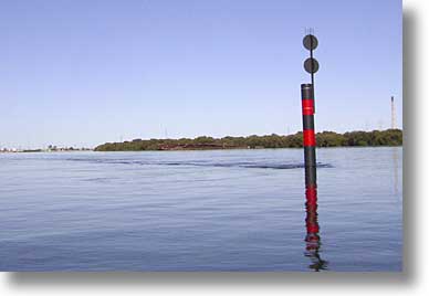
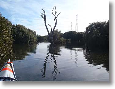
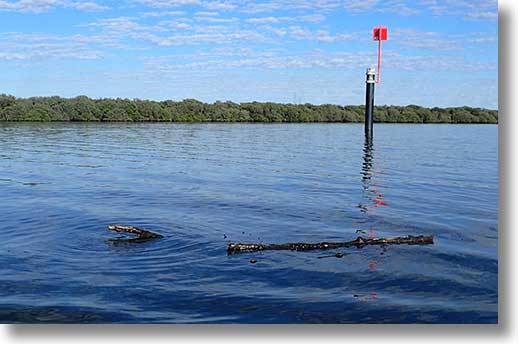
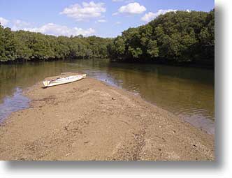
You will also find it much easier to paddle with the tide than against it. The flood tide is southwards, the ebb northwards in the Port River and Barker Inlet. In North Arm and Eastern Passage the flow is to the east at the flood, to the west at ebb, and quite strong in Eastern Passage. The two streams meet in the area opposite Swan Alley Creek, an area known as the ‘partings’. The picture shows the isolated danger mark in North Arm about two hours after high tide: note the wake. (The mark has since been replaced by one with a speed sign.) Santiago is visible in the background, and has continued breaking up.
The flow in creeks can create some hazards. If you find yourself being swept on to a log or branches lean toward the obstacle. Push yourself clear. Lean away, into the current, when you’re up against something and you may well be swept under.
Beware of the barnacles growing on the lower branches: they are sharp and can give nasty cuts if you grab the branches.
The open areas are susceptible to the wind, and can develop a nasty chop: I have seen one metre waves in Lipson Reach in a strong north-westerly. If you’re not accustomed to paddling in wind and chop choose a day with a better forecast.
If you want to land for a break, do so only on sandy beaches or the sandbars which appear at low tide. Bare sand is usually firm, sand with seagrass can be very soft. Avoid areas with mangrove pneumatophores.
On all occasions make sure you have food and water, extra clothing in case it’s colder than you expected, first aid gear, towline, mobile phone and/or marine radio, etc.
Much of the area is inaccessible by land, so don’t plan on walking out if things go wrong. You should make sure you have the ability to get yourself out of those situations. If it really is life threatening, use mobile phone, marine VHF or marine 27MHz to call for aid. In a channel, use beacon numbers, otherwise grid references or GPS coordinates to locate your position. You will have left details of your plans with someone at home (the Float Plan is designed for this)
In mid-2017 channel marks south of beacon 21G were replaced and renumbered. In the picture, new beacon 40 is at left, the old number 22 at right. The speed sign near the old beacon 27, now 52, was removed, replaced by a sign on beacon 52. During 2018 the remaining beacons were replaced and renumbered, and the speed sign near Middle Ground Inner removed.
Southern Eagle Ray
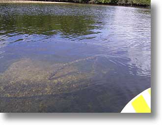
You may be surprised by a sudden flurry and a grey shape speeding away as you paddle in shallows: a Southern Eagle Ray, Myliobatis tenuicaudatus. They do have poisonous spines, but you are unlikely to tread on one. The one in the picture, about a metre across, is definitely deceased.
Bird life
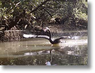
The area is a haven for many marine bird species: several species of cormorant, terns egrets, herons, swans, pelicans, and the inevitable Croicocephalus novaehollandiae. As far as possible, avoid disturbing flocks of birds, whether foraging or resting. Swans tend to congregate near Barque Creek, where the picture was taken, with egrets in the trees.
The creeks
Magazine Creek
Magazine Creek is now inaccessible, flowing out through a concrete structure at 744 447, east of the Speed Boat Club. It was so named because a powder magazine was built at about 737 434 in 1858, and demolished in 1916.
Creek south of Dorothy H Sterling
This short creek is navigable only as far as the embankment: the remains of the ship are more interesting.
North Arm Creek
A wide and shallow creek, really navigable only near high tide. Landing at the embankment at the end is possible, if awkward, and there are views of the artificial Barker Inlet Wetlands whose outflow is into this creek, the salt pans, and Wingfield dump. The outlet of the Islington sewerage works once flowed into this creek, before the Bolivar treatment works were built.
Two small creeks are shown on the north eastern side. The northern one is fairly easy to find at 75814 45230 (34° 48' 37.9" S 138° 32' 56.8" E), but it does not go far before becoming overgrown. The other has two entrances, both small and difficult to find. One is at 76210 44629 (34° 48' 57.7" S 138° 33' 11.8" E), the other at 76234 44593 (34° 48' 58.9" S 138° 33' 12.7" E). At high tide (above 2.0m) it’s possible to paddle as far as the embankment, and then follow it to the upper end of the creek described next.
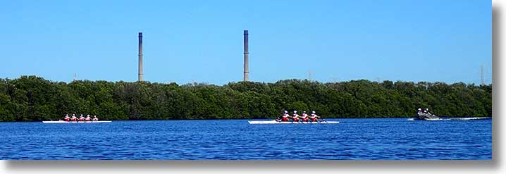
Rowers often use North Arm Creek, as well as North Arm itself and the main river for training. Best to keep well clear.
Work on the Northern Connector began in late 2016: see below for more info.
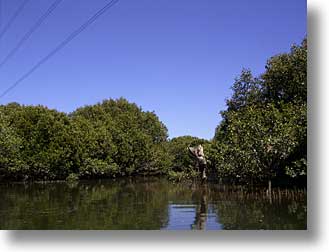
Unnamed creek
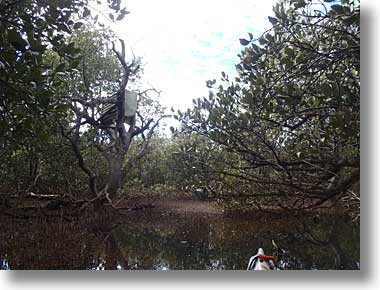
Access to this creek, which some have called Hidden Creek, is through the trees south of the pylon at 758 455. At first it follows the pylon embankment and then turns south. Unlike most creeks, this one opens out to a samphire flat, and at high tide it’s possible to paddle to the boundary embankment, where the picture at right was taken.
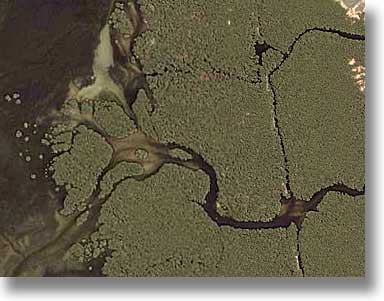
(In the mid 1990s I noticed this creek on the map surveyed in 1937 (see below) and realised that it had been diverted by the powerline embankment. A bit of poking around found the entrance. I took a few groups in, and knowledge spread. (This was well before Google Maps ‘satellite’ view, which now shows the diversion clearly.)
Not shown on the map is a lagoon a little to the east. At high tide there is access off the creek through the mangroves at 76010 45651 (34° 48' 24.4" S 138° 33' 04.9" E) and along the embankment at high tide. The pic at left was taken at the southern end, looking northwest.
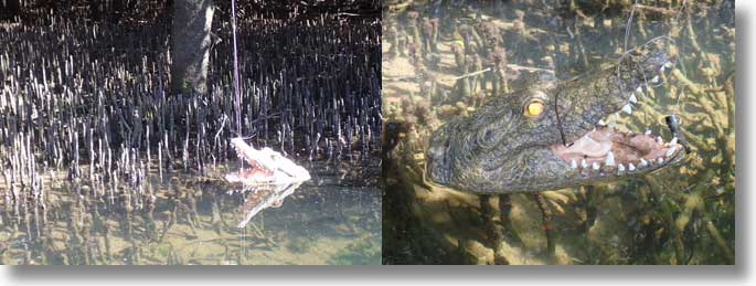
In mid-2014 ‘crocodiles’ were reported in this creek. It turns out that there were three of them, the first at about 761 454. The eyes were reflective. They have since disappeared.
But you will often come across floating mangrove branches. In tropical Australia this would be a ‘logodile’.
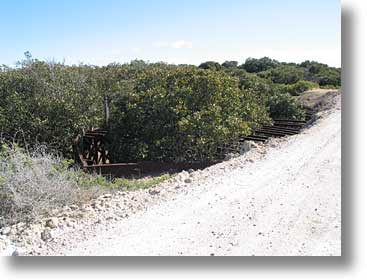
Broad Creek
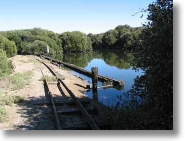
Follow the beacons into Broad Creek to avoid running aground. At the end there are the remains of a wharf and railway line, once used to unload explosives, the last shipment being unloaded in 1970. The magazine was opened in 1903 and closed in 1995, and is still there to the south across the salt pans. Vessels came to here through The Cutting at the northern end of Torrens Island so as to be well away from other shipping. There was also a facility at Snapper Point (725 497) for transferring explosives, behind a protective mound.
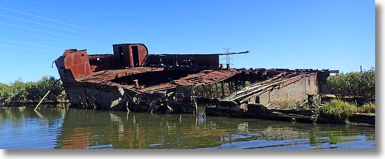
There is a steep ramp up to the embankment (with very soft mud at the bottom), from where the remains of an iron hulk can be seen. It was once a floating explosives store.
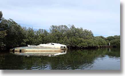
During 2015 a trimaran broke its mooring in Angas Inlet and drifted about, abandoned. It eventually drifted to the upstream end of Broad Creek, and at one stage was on the wharf. Anything of value has been stripped, the port hull is broken off and it now lies partly submerged.
In early 2017 a measuring device on a pole was placed in the water mid-stream near the wharf: part of the Northern Connector project.
During 2020 a culvert was put through the embankment to connect the creek with what had been a salt pan. Mangroves were cleared in the process.
The remains of the Dorothy S are in the nearby side creek, Bream Creek. All that can be seen are the sternpost and a line of ribs and planking
Both Bream Creek and the creek to its west are navigable for short distances. The creek running more or less parallel to the power line embankment is navigable, but can be entered only at mid-tide (I went in at neap tide), otherwise the entrance through the mangroves and around the embankment is blocked by branches and rocks. The stump is near the upstream end
The remains of a launch lie on the sandbar to the north of the Broad Creek entrance, and are exposed at low tide (grid reference is 758 464)
The remains of another vessel lie close to the mangroves to the east at 764 465, and are also visible only at low tide.
Bream Creek mystery object
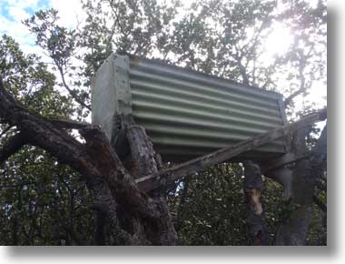
In April 2013 two paddlers exploring Bream Creek reported finding a tank-like object in a tree not far from the embankment at the upstream end of the creek. They were puzzled by it, and had no means of looking inside. Without a GPS they were unable to give a precise location.
On the second attempt, I located the object several weeks later at 0277829 6146035 (UTM), 34° 48′ 13.48″ S 138° 34′ 16.8″ E. Whatever the original contents, a camera on a pole showed the object about half filled with sand and gravel.
A sheet of black plastic was partly buried nearby, with mangrove pneumatophores growing through it and two plastic buckets were lying on the ground a short distance upstream.
Who put the object in place, and for what purpose, is presently unknown.
Update March 2015: According to a SASRS colleague this was an attempt at marijuana cultivation. The plants were in the raised trough, with watering by solar-powered pump. It was unsuccessful and abandoned.
Swan Alley Creek
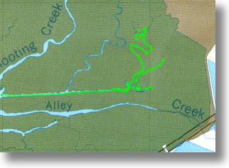
The southern branch is navigable, but its eastern end is blocked. The main channel leads into Dry Creek, a boring manmade channel with suburbia alongside. The straight channel alongside the St Kilda embankment eventually peters out. The Little Para River flows into the area to its northeast, and then out through the eastern creek shown by its GPS track on the map fragment. (These creeks are not shown on the map) (The swan was, appropriately, in the upper part of the main creek, and I followed it slowly. Eventually it decided the only way out was to take off past me.)
Shooting Creek
This creek is navigable for some distance. At low tide there are sandbars near the first real bends, and there is another area at the intersection with Swan Alley Creek that also dries at low tide. This area is now overgrown with mangroves.
St Kilda embankment channel
The St Kilda embankment was built in the late 19th century to reclaim land for agriculture. It was later abandoned after a severe storm. Much of it can still be seen on the western side of the channel alongside. The channel is navigable from Swan Alley Creek as far as Garnets Creek. The section between Garnets and Barque Creek can be entered from the Barque Creek end, but the southern end disappears into overgrown trickles. From Barque Creek the channel can be used with some difficulty to gain access to the creek to its north.
Creek between Shooting and Burrows
There is a creek leading off the embankment channel at 767 477. It goes in some 200 metres and branches. The branches eventually peter out, so you’d need to backtrack
Burrows Creek
A long creek, navigable most of the way to the boundary embankment. The creek meandering westward from Burrows almost to Post Creek is not navigable after a hundred metres or so. At the mouth lies an extensive sandbank, popular with the pelicans, but for some reason not shown on the map. As far as possible, minimise disturbance to the birds.
Post Creek
Post Creek is similar to, but smaller than, Burrows Creek. In the open area at the intersection with the St Kilda embankment channel lie the remains of a launch, most easily visible at low tide, when there are exposed sandbars neaby, with a metal stake and chain embedded in line with the wreck.
Garnets Creek
The easiest access to Garnets Creek is via the St Kilda embankment channel, and there is a prominent sandbar at the intersection. It is navigable for some distance.
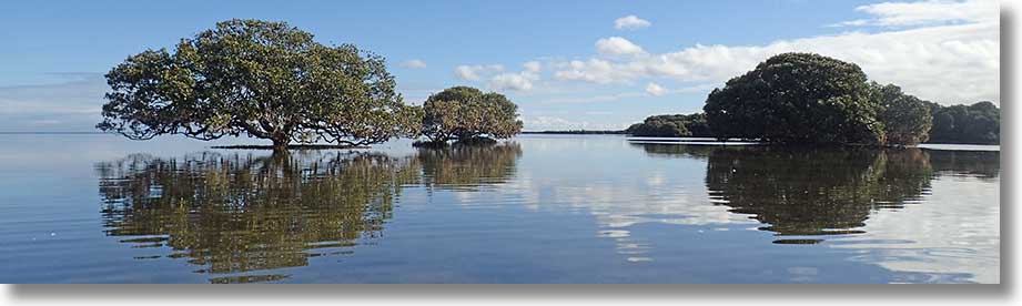
Barque Creek
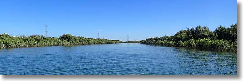
To approach at anything other than high tide, come through the channel, visible at lower left in the aerial view below. Much of the area surrounding the entrances dries at low tide. The creek can be paddled for much of the way to the boundary embankment.
At about 2755 4974/34° 46′ 11.4″ S 138° 32′ 52″ E there is some debris scattered about.
Unnamed creek north of Barque Creek
The only reliable access is through the St Kilda embankment channel, and then only with some difficulty. A pleasant enough little creek, it can be paddled for some distance.
There is a pond centred at 757 501 (missing from the map), accessed through a short creek section which is best navigated at mid tide.
The mouth of the original course is at 754 499, but the creek is overgrown in places and is almost impassable, as seen below. The Google Earth image shows the area more clearly than the map.
Creeks from this point to St Kilda are all small, and the waters in front of them very shallow: you will need a reasonably high tide. The entrance to the only navigable creek is at 748 515, and it goes in to 751 515. A short distance from the entrance the creek is blocked by a fallen tree.
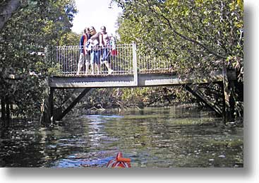
The St Kilda Boardwalk is not shown correctly on the map. Its end loop is at 745 520, and it follows the edge of the mangroves for some distance northwards, where there is a lookout tower. The boardwalk is a popular destination for school excursions, allowing students a close inspection without getting their feet wet (or damaging pneumatophores)
Torrens Island
As the map notes suggest, a circumnavigation makes a good day trip. You want a reasonably high tide (at least 0.9m) to use The Cutting (once maintained to allow passage of explosives vessels) or high tide to pass around Point Grey. Miscalculate and you may be walking.
For lunch breaks, there is a stretch of sandy beach north of the Quarantine Station. The two small beaches on the eastern side, noted on the reverse of the map, are now (2012) overgrown and unusable.
The small beach on the western side, at 727 506, is now overgrown also.
The Quarantine Station and power station are closed to the public, and you should not land near them except in emergency. If you do have trouble along this stretch of water there is easier access if you land on the Lefevre Peninsula side. The most accessible point is at 726 495, at the end of a dirt road off Mersey Road North, opposite Archie Badenoch Circuit, past the remains of the Excelsior.
This is the Middle Ground Inner beacon. Fluffy clouds and lack of waves show a good day.
French Tom Creek
Named for a fisherman of long ago, this creek leads to the interior of the island. At its upstream end there is a fork. The left branch almost turns back on itself and the right branch also turns left and disappears into mangroves. The creek on the northern side at 738 478 is navigable for a short distance.
Three creeks off Angas Inlet
The western and middle creeks off Angas Inlet are easily accessible and are often paddled. According to a manuscript amendment on a chart from the St Kilda Boat Club, the western creek is named Jocks Creek.
At low tide the remains of a launch are exposed near the Jocks Creek entrance. Nearby is a recently abandoned large launch.
Farther west are the remains of another vessel, thought to be the Kadina.
The entrance to the eastern creek is behind a sandbar directly opposite beacon 58 (with 4kn speed sign). The entrance is shallow and narrow, but the creek widens into a pool. Progress from there is blocked. (In early 2011 a fallen tree blocked this creek not far from the entrance.)
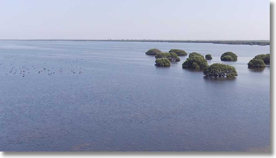
At the eastern end of Garden Island is a channel, blocked by the power line causeway. The remains of Santiago are near the southern end, with the end of the boardwalk at the northern end. This is apparently known as Cassiopia Inlet
Others
Several other creeks exist on the island, one having an entrance near the Middle Ground Inner beacon. There are gaps in the GPS track because of shielding by trees. Note that meanders near the entrance are not shown on the map.
Farther north, another has its entrance at 73434 50319 (34° 45′ 51.0″ S 138° 31′ 28.2″ E), past some fallen branches.
Mutton Cove
This area is now accessible through a gap in the embankment at 7245 4868/34° 46′ 43.2″ S 138° 30′ 48.0″. As seen above, Mutton Cove Creek extends almost straight at 340°M, with the remains of Excelsior, below, at the upstream end.
A side branch to the west has the remains of Jupiter, visible only at low tide. (You will need at least mid tide to be able to paddle these creeks.) Another creek branches off the eastern side and can be paddled for some distance.
The nearest launching point is a small beach accessible by unsealed track off Mersey Road North at 726 496.
New landmark
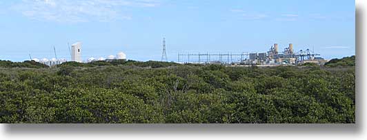
A new bulk grain berth has been built at Outer Harbor, and the new silo and its conveyer are visible over a wide area. The picture, taken on Torrens Island on 20 April 2007, shows the first tower of the conveyer at left. To the right are the Pelican Point power station, and Outer Harbor container cranes beyond. As best as I can place the tower from a number of bearings, it is at 715 495.
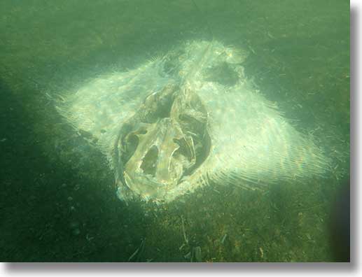
Ships’ Graveyard
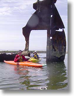
Wrecks are all shown on the map, with an inset for the main area in North Arm. For details of the ships, see the Ships’ Graveyards Web site. The pic is of the remains of the Glaucus, and everybody paddles through where the propeller once was.
The Black Pole
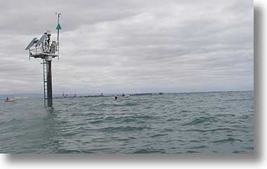
If you want some paddling out in the open, the Section Bank pile beacon, commonly known as The Black Pole, might be a good target. It’s at 679 535/34° 44′ 3″ S 138° 27′ 55″ E (off the map), and really is a black pole, topped by the navigation light (flashing, 1 second) and the wind instruments. (The Black Pole is the site for Outer Harbor weather observations) It seems to be a popular fishing spot.
As it was
I have in my collection a copy of a map surveyed in 1937. Here’s a portion of it, approximately the area covered by the new map. The ships’ graveyard (or cemetery) is visible, as is the Dorothy H Sterling. The St Kilda embankment is prominent. Note also the track from Broad Creek to the magazine in the south east corner.
This is well before the Torrens Island power station, which was not built until the 1960s, and there are many other interesting differences. Don’t attempt to reconcile the grid on this map with the current Zone 54H metric grid.
Future plans
There were plans to reprint the map every couple of years, incorporating corrections and new features as required, but this will not happen. On the current map some creeks are not shown in their correct colours, and the latitude and longitude scales and nautical mile scale bar that I had put on the first drafts are missing. As noted above, the Burrows Creek sandbar is missing, and the bulk grain facility has been built, ASC expanded, etc.
The effort is now going into web-based resources, with Paddling Trails South Australia offically launched on 26 February 2020. There are dowloadable PDF maps, and links to Avenza maps for use on mobile devices. Trips to the ships’ graveyard, Port River exploration, Swan Alley Creek and Torrens Island circumnavigation are listed on the Adelaide Region page.
An inconsistency on the site is that coordinates of launch sites, etc. are given in latitude and longitude as decimal degrees (e.g. Garden Island Ramp 34.8046° S; 138.5400° E) but the maps use the UTM grid, eastings and northings. One conversion utility is at www.latlong.net/lat-long-utm.html. Remember that south latitudes must be entered as negative numbers, e.g. -34.8046.
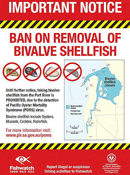
Pacific Oyster Mortality Syndrome (POMS)
In February 2018 Pacific Oyster Mortality Syndrome (POMS) was detected in the Port River. Bans on the removal of bivalves were put in place, together with a request to clean all boats and other equipment before leaving the area. For more, see the PIRSA site.
Other information
Wikipedia has a Barker Inlet page with general information.
Wikipedia also has a page describing the Dry Creek explosives depot
Grey Mangrove: Avicennia marina var. resinifera
The Grey Mangrove, Avicennia marina, occurs widely across Indian Ocean and Australian areas. For more information, see the Wikipedia entry.
Guided tours
Adventure Sea Kayaking SA offers tours to the Ships’ Graveyard and through the mangrove creeks, with a fleet of double sea kayaks.
Adelaide Dolphin Sanctuary
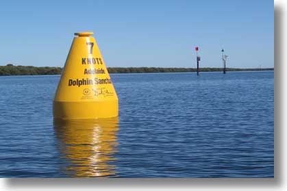
There is no guarantee that you will see dolphins every time you visit the area, but if you do you will be rewarded by the experience, especially if they come close. The Port River and Barker Inlet are parts of the Adelaide Dolphin Sanctuary, and the website has more information and resources
In early 2013 three buoys were placed in the area to remind boat users of the speed limit (Middle Ground Inner beacon in the background). By mid-2016 they had broken their moorings and been removed. By early 2018 irresponsible behaviour by powerboat operators was causing concern, leading to moves to have them reinstated.
The buoy opposite the Garden Island ramp disappeared for a time, presumably drifted into one of the creeks, and then reappeared a short distance east of the boardwalk. I waited for high tide on 2 June 2016 and towed it to the ramp where students carried it up to the lawn. It was retrieved by DEWNR and placed in storage.
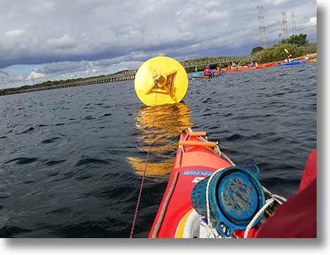
In May 2018, after the Protect Our Dolphins campaign by Messenger Press Community News, the buoys were reinstated. One is opposite the Garden Island ramp, another at the Angas Inlet and North Arm confluence and the third (pictured) near the Middle Ground Inner beacon, where it replaces the speed sign. They now have spikes to deter birds.
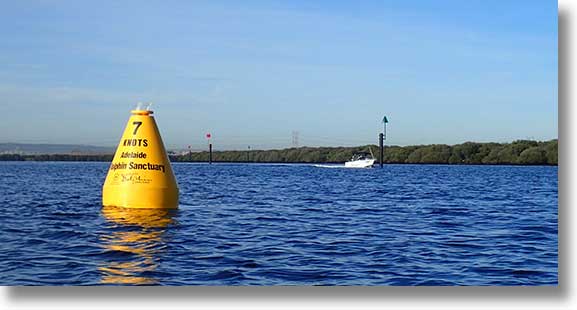
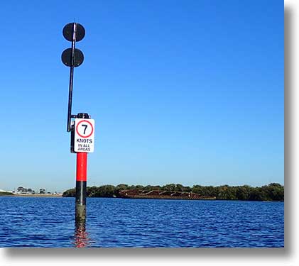
The campaign asked for a 10 knot speed limit throughout the sanctuary, but the limit effective from 29 April 2019 is 7 knots overall as far north in Barker Inlet as the St Kilda breakwater but with no limit in the channel from Beacon 35 (adjacent to Middle Ground Inner) northwards. In North Arm there is a 50m wide 7 knot corridor along the northern bank between the Dorothy H Sterling and the bridge. South of the corridor speeds are not limited (for the Speedboat Club).
Many channel marks now have speed signs, as does the refurbished isolated danger mark in North Arm and there is a new pile with speed sign near the Dorothy H Sterling. Notice to Mariners No 13 of 2019 gives its position as 34° 48' 44.4" S 138° 32' 21.2" E.

Estuary Care Foundation
A key objective of The Estuary Care Foundation is Conserve, protect, enhance and promote the ecology of the Port River and Barker Inlet Estuary, and the benefits thus provided.
Seagrass Restoration
The Department for Environment and Water is undertaking a Seagrass Restoration Project to maintain and restore vital seagrass meadows along the coast and in Barker inlet.

Save St Kilda Mangroves Foundation
The Save St Kilda Mangroves Foundation was formed on 23 January 2021 in response to the dieback of mangroves near the St Kilda township caused by hypersaline water leaching from disused salt pans.
Adelaide International Bird Sanctuary
The now disused salt pans to the east and areas to their north are to be developed as a sanctuary for migratory birds. For more, see the Sanctuary site.
Angas Inlet Boat Club
AIBC is the club based just north of the Garden Island boat ramp.
Garden Island Yacht Club
GIYC is based in Angas Inlet, occupying the eastern marina and ramp area.
Small Boat Club of SA
The area in Angas Inlet nearest the power station is the home of the Small Boat Club.
Please do not paddle through marina areas: stay clear on the northern side.
Airspace
The airspace above Barker Inlet is part of the lane of entry to Parafield Airport, clear of the Edinburgh RAAF airspace. Northbound aircraft will be on the eastern side, southbound (to YPPF) on the western, with Outer Harbor as the reporting point.
Friends of Torrens Island (FoTI)
During 2012 a group with a range of interests in Torrens Island worked towards inaugurating a Friends of Torrens Island organisation. A committee met regularly, a constitution was drafted and newsletters published, with the aim of holding an inaugural general meeting, which was held on 27 November 2013. The FoTI website is currently offline but there is a presence on Facebook.
A picnic was held at the Quarantine Station in January 2012 and a second in January 2013. The following pics are from the 2013 event. Annual General Meetings have since been held at the station.
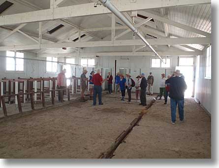
People arriving at the station for quarantine were showered and issued with clean clothes. Much of the interior of the shower building has been removed but some remains.
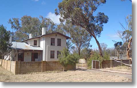
Still in reasonable condition is Refshauge House, the manager’s residence. Other buildings dating from the 1950s are also in resonable condition but older structures are in various states of disrepair. During 2015–2016 DPTI funded cleanup and maintenance of the area and buildings.
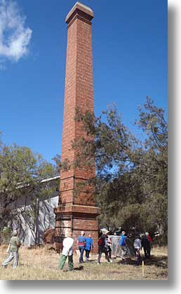
The station was as independent of water and power supplies as possible, with power coming from steam driven generation. The machinery is gone but the chimney remains as a landmark.
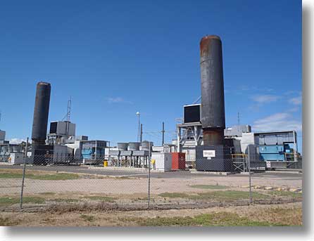
Just to the south is the Origin Energy Quarantine Power Station. There are four gas turbine generator systems, two of which are shown here.
Proposed projects
In late 2016 two environmental projects were being planned, one to reintroduce oysters to selected areas, the other to survey the state of seagrasses in the Port River and Barker Inlet. The seagrass survey is now being conducted by members of Defence Shed Port Adelaide, by kayak.
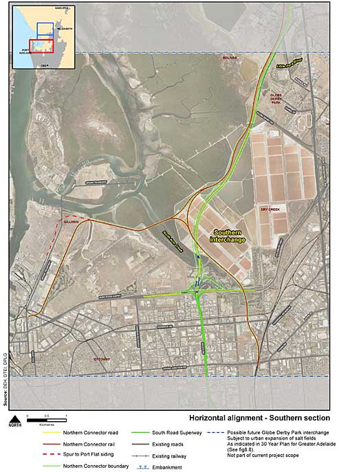
The Northern Connector
The South Australian government plans to build housing on what are now salt pans and a rail and road corridor along the eastern side of Barker Inlet. For some details see the Northern Connector pages at the DPTI site, from which this map comes:
Work on the Northern Connector road system began in late 2016. The photographs below were taken on 15 September 2017.
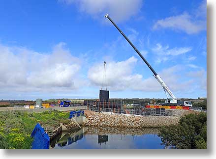
Crane at work at the upstream and of North Arm Creek.
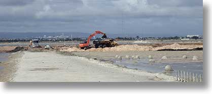
A view across the salt pans from the end of Broad Creek, with machinery at work. The works road crosses the Dry Creek channel just past the upstream end of Swan Alley Creek.
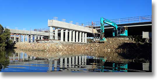
By late June 2019 one span of the bridge across North Arm Creek was in position and an excavator was removing rock from a temporary embankment.
The area between Grand Trunkway and North Arm Creek is also being developed for industrial use. Increased boat traffic, noise, pollution, damage to heritage sites... Effects on marine and bird life can only be detrimental.
A scene north of Barque Creek. (Do take note of the tides.)